 |
|
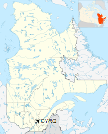
Trois-Rivières Airport (IATA: YRQ, ICAO: CYRQ) is located near the city of Trois-Rivières, Quebec, Canada.
The airport is classified as an airport of entry by Nav
Canada and is staffed by the Canada Border Services Agency (CBSA).
CBSA officers at this airport can handle general aviation aircraft
only, with no more than 15 passengers.
In the spring of 2009, work began to extend the runway to 9,006 ft (2,745 m), in order to
accommodate Boeing 767 aircraft. The threshold of runway 05 was extended towards the south of the airport.
Trois-Rivières Airport
Aéroport de Trois-Rivières |
- IATA: YRQ
- ICAO: CYRQ
- WMO: 71729
|
| Summary |
| Airport type |
Public |
| Operator |
Airport |
| Location |
Trois-Rivières, Quebec |
| Time zone |
EST (UTC−05:00) |
| • Summer (DST) |
EDT (UTC−04:00) |
| Elevation AMSL |
199 ft / 61 m |
| Coordinates |
46°21′06″N
072°40′50″W |
| Website |
https://www.idetr.com/en/airport |
| Map |
|
Location in Quebec
|
| Runways |
| Direction |
Length |
Surface |
| ft |
m |
05/23 |
9,006 |
2,745 |
Asphalt |
|
| Statistics (2010) |
| Aircraft movements |
18,716 |
|
|
Source: Canada Flight Supplement
Environment Canada
Movements from Statistics Canada. |
The above content comes from Wikipedia and is published under free licenses – click here to read more.
| General Info
|
| Country |
Canada
|
| ICAO ID |
CYRQ
|
| Time |
UTC-5(-4DT)
|
| Latitude |
46.352779
46° 21' 10.00" N
|
| Longitude |
-72.679444
072° 40' 46.00" W
|
| Elevation |
199 feet
61 meters
|
| Type |
Civil
|
| Magnetic Variation |
016° W (01/06)
|
| Beacon |
Yes
|
| Operating Agency |
CIVIL GOVERNMENT, (LANDING FEES AND DIPLOMATIC CLEARANCE MAY BE REQUIRED)
|
| Operating Hours |
24 HOUR OPERATIONS
|
| International Clearance Status |
Airport of Entry
|
| Daylight Saving Time |
Second Sunday in March at 0200 to first Sunday in November at 0200 local time (Exception Arizona and that portion of Indiana in the Eastern Time Zone)
|
| Communications
|
MF/UNICOM
UNICOM opr ltd hr.
|
123.0
|
| MONTREAL CNTR |
128.22
229.2
|
| Communications Remarks |
|
| CNTR |
APP/DEP svc)
|
| Runways
|
ID
|
Dimensions |
Surface |
PCN |
ILS
|
| 05/23 |
6000 x 150 feet
1829 x 46 meters |
ASPHALT |
076FBWT |
NO
|
| Navaids
|
| Type |
ID |
Name |
Channel |
Freq |
Distance From Field |
Bearing From Navaid
|
| NDB |
YRQ |
TROIS RIVIERES |
- |
205 |
1.2 NM |
228.0
|
| Supplies/Equipment
|
| Fuel |
Jet B, Wide cut turbine fuel, Without icing inhibitor.
100/130 MIL Spec, low lead, aviation gasoline (BLUE)
|
| Other Fluids |
DE-ICE, Anti-icing/De-icing/Defrosting Fluid (MIL A 8243)
|
| Remarks
|
| CAUTION |
Glider haz 3 NM rad of arpt up to 3000' daytime Sat, Sun and hol mid Apr to mid Jun and mid Aug to end of Oct.
|
| FLUID |
De-ice
|
| FUEL |
(NC-100LL, A1+ - Avbl 1300-0100Z++ C819-377-4382, OT call out fee 1 hr PN C819-695-0502.)
|
| LGT |
ACTIVATE-MIRL Rwy 05-23 and REIL, PAPI Rwy 23-CTAF. PAPI Rwy 23, 12 lgt unit foracft with eye-to-wheel hgt up to 10'.
|
| MISC |
Twy A 75' wide and Twy B 33' wide and unlgtd. Ldg fee.
|
| RSTD |
Twy B for acft with wheel track of less than 23'.
|
| TFC PAT |
Rwy 05 rgt tfc.
|
The content above was published at Airports-Worldwide.com in 2019.
We don't guarantee the information is fresh and accurate. The data may
be wrong or outdated.
For more up-to-date information please refer to other sources.
|
|


