 |
|
Sherbrooke Airport, (IATA: YSC, ICAO: CYSC), is a registered aerodrome
located 9 nautical miles (17 km; 10 mi) east northeast of Sherbrooke, in the municipality of Cookshire-Eaton, Quebec, Canada.
The airport is classified as an airport of entry by Nav Canada and is staffed by the
Canada Border Services Agency (CBSA). CBSA officers at this airport can handle aircraft with up to 30 passengers.
|
Sherbrooke Airport |
- IATA: YSC
- ICAO: CYSC
- WMO: 71610
|
| Summary |
| Airport type |
Public |
| Operator |
CDAS (Corporation développement Aéroport de Sherbrooke) |
| Location |
Cookshire-Eaton, Quebec |
| Time zone |
EST (UTC−05:00) |
| • Summer (DST) |
EDT (UTC−04:00) |
| Elevation AMSL |
792 ft / 241 m |
| Coordinates |
45°26′19″N
071°41′29″W |
| Website |
http://www.aeroportdesherbrooke.com (French) |
| Map |
|
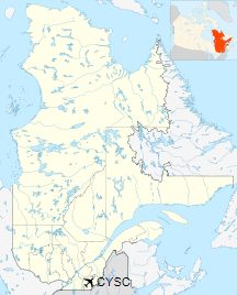
Location in Quebec
|
| Runways |
| Direction |
Length |
Surface |
| ft |
m |
13/31 |
5,901 |
1,799 |
Asphalt |
|
| Statistics (2010) |
|
|
|
Source: Canada Flight Supplement
Environment Canada
Movements from Statistics Canada. |
History
Weekday flights connecting Toronto were discontinued in 2009.
Airlines and destinations
There are no scheduled commercial services as of July 2017.
However, occasional charter flights land at Sherbrooke airport,
notably from Jazz or Nolinor.
Navigation aids
A VOR-DME installation, with radio identifier YSC, is located 8.4 nautical miles
(15.6 km) south-west from the airfield. An NDB, identifier SC, is located on the
approach to runway 13, 4.6 nautical miles (8.5 km) north-west from the airport.
The above content comes from Wikipedia and is published under free licenses – click here to read more.
| General Info
|
| Country |
Canada
|
| ICAO ID |
CYSC
|
| Time |
UTC-5(-4DT)
|
| Latitude |
45.438611
45° 26' 19.00" N
|
| Longitude |
-71.691389
071° 41' 29.00" W
|
| Elevation |
792 feet
241 meters
|
| Type |
Civil
|
| Magnetic Variation |
016° W (02/06)
|
| Beacon |
Yes
|
| Operating Agency |
PRIVATE
|
| Operating Hours |
24 HOUR OPERATIONS
|
| International Clearance Status |
Airport of Entry
|
| Daylight Saving Time |
Second Sunday in March at 0200 to first Sunday in November at 0200 local time (Exception Arizona and that portion of Indiana in the Eastern Time Zone)
|
| Communications
|
CTAF/UNICOM
UNICOM opr 1300-0100Z++ May-Sep; 1300-2300Z++ Oct-Apr.
|
123.5
|
| QUEBEC RDO |
SEE REMARKS
|
| MONTREAL CNTR |
132.55
226.0
|
| AWOS |
126.25
|
MF
Opr ltd hr.
|
123.5
|
| Communications Remarks |
|
| RCO |
(123.25 GCO. Key 4 times).
|
| CNTR |
(APP/DEP svc)
|
| AWOS |
C819-832-1567.
|
| Runways
|
ID
|
Dimensions |
Surface |
PCN |
ILS
|
| 13/31 |
6000 x 150 feet
1829 x 46 meters |
ASPHALT |
054FCWT |
NO
|
| Navaids
|
| Type |
ID |
Name |
Channel |
Freq |
Distance From Field |
Bearing From Navaid
|
| VORTAC |
YSC |
SHERBROOKE |
079X |
113.2 |
8.4 NM |
045.3
|
| NDB |
SC |
SHERBROOKE |
- |
362 |
4.6 NM |
134.0
|
| Supplies/Equipment
|
| Fuel |
Jet B, Wide cut turbine fuel, Without icing inhibitor.
100/130 MIL Spec, low lead, aviation gasoline (BLUE)
|
| Remarks
|
| CAUTION |
Deer haz. First 2000' Rwy 13 slopes up 1.4 percent.
|
| FUEL |
(NC-100LL, A1+ - Avbl 1300-0100Z++ May-Sep; 1300-2300Z++ Oct-Apr C819-832-4314; OT C819-570-2931, 1 hr PN rqr, call out fee may be levied.)
|
| LGT |
ACTIVATE-MIRL Rwy 13-31, ODALS Rwy 13 and PAPI Rwy 31-CTAF. PAPI Rwy 31 for acftwith eye-to-wheel hgt up to 10'.
|
The content above was published at Airports-Worldwide.com in 2019.
We don't guarantee the information is fresh and accurate. The data may
be wrong or outdated.
For more up-to-date information please refer to other sources.
|
|


