 |
|
Sept-Îles Airport (IATA: YZV, ICAO: CYZV) is situated 4.5 nautical miles (8.3 km; 5.2 mi) east of the town of Sept-Îles, Quebec, Canada.
The airport is classified as an airport of entry by Nav Canada and is staffed by the Canada Border Services Agency (CBSA) on a call-out basis from the Quebec City Jean Lesage International Airport. CBSA officers at this airport can handle general aviation aircraft only, with no more than 15 passengers.
Sept-Îles Airport
Aéroport de Sept-Îles |
- IATA: YZV
- ICAO: CYZV
- WMO: 71279
|
| Summary |
| Airport type |
Public |
| Operator |
Transport Canada |
| Location |
Sept-Îles, Quebec |
| Time zone |
EST (UTC−05:00) |
| • Summer (DST) |
EDT (UTC−04:00) |
| Elevation AMSL |
180 ft / 55 m |
| Coordinates |
50°13′24″N
066°15′56″W |
| Map |
|
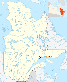
Location in Quebec
|
| Runways |
| Direction |
Length |
Surface |
| ft |
m |
09/27 |
6,552 |
1,997 |
Asphalt |
13/31 |
5,771 |
1,759 |
Asphalt |
|
| Statistics (2010/2011) |
| Aircraft movements |
29,922 (2,011) |
| Total Passengers |
106,108 (2,010) |
|
|
Sources: Canada Flight Supplement
Environment Canada
Movements from Statistics Canada
Passenger numbers from Statistics Canada |
Map of the airport.
Airlines and destinations
| Airlines |
Destinations |
| Air Canada Express |
Montréal–Trudeau, Quebec City, Wabush |
| Air Inuit |
Kuujjuaq, Montréal–Trudeau, Quebec City, Schefferville, Wabush |
| Air Liaison |
Baie-Comeau, Havre Saint-Pierre, La Romaine, Port-Menier, Natashquan, Quebec City, Saint-Augustin, Blanc Sablon |
| PAL Airlines |
Blanc Sablon, Chevery, Montréal–Trudeau, Natashquan, Quebec City, Saint-Augustin, Wabush |
| Pascan Aviation |
Bagotville, Baie-Comeau, Mont-Joli, Montréal-Saint-Hubert, Quebec City, Wabush |
| Strait Air |
Îles-de-la-Madeleine |
| Sunwing Airlines |
Seasonal: Cancún, Punta Cana (begins December 12, 2018) |
The above content comes from Wikipedia and is published under free licenses – click here to read more.
| General Info
|
| Country |
Canada
|
| ICAO ID |
CYZV
|
| Latitude |
50.223333
50° 13' 24.00" N
|
| Longitude |
-66.265556
066° 15' 56.00" W
|
| Elevation |
180 feet
55 meters
|
| Type |
Civil
|
| Magnetic Variation |
020° W (01/06)
|
| Operating Agency |
CIVIL GOVERNMENT, (LANDING FEES AND DIPLOMATIC CLEARANCE MAY BE REQUIRED)
|
| Alternate Name |
SEVEN ISLANDS
|
| Daylight Saving Time |
Second Sunday in March at 0200 to first Sunday in November at 0200 local time (Exception Arizona and that portion of Indiana in the Eastern Time Zone)
|
| Communications
|
| MF |
118.1
|
| QUEBEC RDO |
123.15
126.7
|
| RDO |
118.1
|
| MONTREAL CNTR |
135.55
381.9
|
ATIS
Opr 1115-0315Z++.
|
124.8
|
| Communications Remarks |
|
| RCO |
(RCO)
|
| FSS |
Emerg only C418-962-8229
|
| CNTR |
(APP DEP svc)
|
| Runways
|
ID
|
Dimensions |
Surface |
PCN |
ILS
|
05/23
CLOSED |
5900 x 200 feet
1798 x 61 meters |
ASPHALT |
- |
NO
|
| 09/27 |
6552 x 150 feet
1997 x 46 meters |
ASPHALT |
067FAWT |
NO
|
| 13/31 |
5771 x 200 feet
1759 x 61 meters |
ASPHALT |
067FAWT |
NO
|
| Navaids
|
| Type |
ID |
Name |
Channel |
Freq |
Distance From Field |
Bearing From Navaid
|
| VOR |
YZV |
SEPT ILES |
- |
114.5 |
At Field |
-
|
| TACAN |
UZV |
SEPT ILES |
092X |
- |
At Field |
-
|
| NDB |
ZV |
SEPT ILES |
- |
273 |
4.5 NM |
306.6
|
| Supplies/Equipment
|
| Fuel |
Jet B, Wide cut turbine fuel, Without icing inhibitor.
Jet A1, without icing nhibitor.
100/130 MIL Spec, low lead, aviation gasoline (BLUE)
|
The content above was published at Airports-Worldwide.com in 2019.
We don't guarantee the information is fresh and accurate. The data may
be wrong or outdated.
For more up-to-date information please refer to other sources.
|
|


