 |
|
Saint-Bruno-de-Guigues Aerodrome |
Saint-Bruno-de-Guigues Aerodrome, (TC LID: CTA4), is located 7 nautical miles (13 km; 8.1 mi) north of Saint-Bruno-de-Guigues, Quebec, Canada.
|
Saint-Bruno-de-Guigues Aerodrome |
- IATA: none
- ICAO: none
- TC LID: CTA4
|
| Summary |
| Airport type |
Public |
| Operator |
Transports Québec |
| Location |
Saint-Bruno-de-Guigues, Quebec |
| Time zone |
EST (UTC−05:00) |
| • Summer (DST) |
EDT (UTC−04:00) |
| Elevation AMSL |
820 ft / 250 m |
| Coordinates |
47°26′57″N
079°25′05″W |
| Map |
|
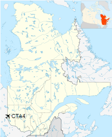
Location in Quebec |
| Runways |
| Direction |
Length |
Surface |
| ft |
m |
10/28 |
4,494 |
1,370 |
Asphalt |
|
|
Source: Canada Flight Supplement |
The above content comes from Wikipedia and is published under free licenses – click here to read more.
| General Info
|
| Country |
Canada
|
| Latitude |
47.449167
47° 26' 57.00" N
|
| Longitude |
-79.418056
079° 25' 05.00" W
|
| Elevation |
820 feet
250 meters
|
| Magnetic Variation |
012° W (08/06)
|
| Beacon |
Yes
|
| Operating Agency |
CIVIL GOVERNMENT, (LANDING FEES AND DIPLOMATIC CLEARANCE MAY BE REQUIRED)
|
| Daylight Saving Time |
Second Sunday in March at 0200 to first Sunday in November at 0200 local time (Exception Arizona and that portion of Indiana in the Eastern Time Zone)
|
| Communications
|
| QUEBEC RDO |
126.7
|
| CTAF |
123.2
|
| Communications Remarks |
|
| RDO |
(APP DEP svc)
|
| Runways
|
| ID |
Dimensions |
Surface |
PCN |
ILS
|
| 10/28 |
4489 x 100 feet
1368 x 30 meters |
ASPHALT |
- |
NO
|
| Navaids
|
| Type |
ID |
Name |
Channel |
Freq |
Distance From Field |
Bearing From Navaid
|
| NDB |
YBM |
ST-BRUNO DE GUIGUES QUE |
- |
230 |
At Field |
-
|
| Supplies/Equipment
|
| Fuel |
Jet B, Wide cut turbine fuel, Without icing inhibitor.
100/130 MIL Spec, low lead, aviation gasoline (BLUE)
|
The content above was published at Airports-Worldwide.com in 2020.
We don't guarantee the information is fresh and accurate. The data may
be wrong or outdated.
For more up-to-date information please refer to other sources.
|
|


