Saguenay/Saint-Charles-de-Bourget Water Aerodrome |
Saguenay/Saint-Charles-de-Bourget Water Aerodrome, (TC LID: CSA5), is located on the
Saguenay River, 5.8 nautical miles (10.7 km; 6.7 mi) west northwest of Saint-Charles-de-Bourget, Quebec, Canada.
|
Saguenay/Saint-Charles-de-Bourget Water Aerodrome |
- IATA: none
- ICAO: none
- TC LID: CSA5
|
| Summary |
| Airport type |
Private |
| Operator |
Michel Guay |
| Location |
Saint-Charles-de-Bourget, Quebec |
| Time zone |
EST (UTC−05:00) |
| • Summer (DST) |
EDT (UTC−04:00) |
| Elevation AMSL |
230 ft / 70 m |
| Coordinates |
48°30′34″N
071°27′50″W |
| Map |
|
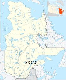
Location in Quebec
|
| Runways |
| Direction |
Length |
Surface |
| ft |
m |
n/a |
n/a |
n/a |
Water |
|
|
Source: Water Aerodrome Supplement |
The above content comes from Wikipedia and is published under free licenses – click here to read more.
The content above was published at Airports-Worldwide.com in 2019.
We don't guarantee the information is fresh and accurate. The data may
be wrong or outdated.
For more up-to-date information please refer to other sources.
|


