 |
|
Mont-Joli Airport (IATA: YYY, ICAO: CYYY) is located 1.5 nautical miles (2.8 km; 1.7 mi) north northwest of Mont-Joli, Quebec, Canada. It is the only airport with scheduled service in Bas-Saint-Laurent region.
| Mont-Joli Airport |
- IATA: YYY
- ICAO: CYYY
- WMO: 71718
|
| Summary |
| Airport type |
Public |
| Operator |
Régie Intermunicipale |
| Location |
Mont-Joli, Quebec |
| Time zone |
EST (UTC−05:00) |
| Summer (DST) |
EDT (UTC−04:00) |
| Elevation AMSL |
172 ft / 52 m |
| Coordinates |
48°36′32″N
068°12′29″W |
| Website |
aeroportmontjoli.com |
| Map |
|
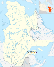
Location in Quebec
|
| Runways |
| Direction |
Length |
Surface |
| ft |
m |
06/24 |
6,000 |
1,829 |
Asphalt |
15/33 |
3,954 |
1,205 |
Asphalt |
|
| Statistics (2010) |
|
|
History
World War II
In the summer of 1940 the Royal Canadian Air Force selected a flat area of farmland between Mont-Joli Station (on the Montreal-Halifax Canadian National Railway mainline) and the Saint Lawrence River for a military airfield. Construction on the aerodrome began in October 1941 and was completed by April 1942 at a cost of $200,000. Three paved runways and 50 buildings were constructed for what became known as RCAF Station Mont-Joli.
Apron, terminal, and control tower
Inaugurated on April 15, 1942, RCAF Station Mont-Joli was a training base for the British Commonwealth Air Training Plan and hosted No. 9 Bombing and Gunnery School from 15 December 1941 until 14 April 1945. RCAF Station Mont-Joli was used by RCAF Eastern Air Command during the Battle of the St. Lawrence as a coastal patrol base; during 1942–1944, Canadian cargo ships and warships were sunk by German U-boats in an effort to close the Saint Lawrence Seaway off to shipping. Aircraft staging out of Mont-Joli were among those used to ward off U-boats and ensure the safety of shipping to the eastern tip of the Gaspé Peninsula at Cap-Gaspé.
World War II plane in operation at Mont-Joli Airport
Aerodrome information
In approximately 1942 the aerodrome was listed at 48°36′N 68°12′W with a Var. 24 degrees W and elevation of 100 feet (30 m). The aerodrome was listed as with three runways as follows:
| Runway Name |
Length |
Width |
Surface |
| 6/24 |
5,000 feet (1,524 m) |
150 feet (46 m) |
4000' paved |
| 16/34 |
4,600 feet (1,402 m) |
150 feet (46 m) |
4000' paved |
| 2/20 |
5,000 feet (1,524 m) |
150 feet (46 m) |
4300' paved |
Post war (1945–1995)
RCAF Station Mont-Joli was decommissioned by the air force in 1945 and became the property of the Department of Transport (now Transport Canada) on December 15, 1945 for use as a civilian airport.
Current (1995–present)
Its ownership was transferred again in 1995 to the "Régie intermunicipale de l’aéroport régional de Mont-Joli". It is the busiest airport in eastern Quebec, though still very far from the Québec/Jean Lesage International Airport in Quebec City and Montréal-Pierre Elliott Trudeau International Airport in Montreal.
In 2007 a second runway (15/33) was opened and runway 06/24 decreased in length from 6,000 ft (1,829 m) to 5,000 ft (1,524 m). In 2017, runway 06/24 was once again extended to 6,000 ft (1,829 m), in order to accommodate the B737-800. Sunwing Airlines started flying that aircraft type from Mont-Joli to Punta Cana in December 2017.
Airlines and destinations
| Airlines |
Destinations |
| Air Canada Express |
Baie-Comeau, Montreal-Trudeau |
| Air Liaison |
Baie-Comeau, Havre Saint-Pierre, Quebec City, Sept-Îles, Wabush |
| PAL Airlines |
Wabush |
| Pascan Aviation |
Bagotville, Îles-de-la-Madeleine, Montréal-Saint-Hubert, Quebec City, Sept-Îles, Wabush |
| Sunwing Airlines |
Seasonal: Cancún, Punta Cana |
The above content comes from Wikipedia and is published under free licenses – click here to read more.
| General Info
|
| Country |
Canada
|
| ICAO ID |
CYYY
|
| Latitude |
48.608612
48° 36' 31.00" N
|
| Longitude |
-68.208056
068° 12' 29.00" W
|
| Elevation |
172 feet
52 meters
|
| Magnetic Variation |
019° W (01/06)
|
| Beacon |
Yes
|
| Operating Agency |
CIVIL GOVERNMENT, (LANDING FEES AND DIPLOMATIC CLEARANCE MAY BE REQUIRED)
|
| Daylight Saving Time |
Second Sunday in March at 0200 to first Sunday in November at 0200 local time (Exception Arizona and that portion of Indiana in the Eastern Time Zone)
|
| Communications
|
| MF |
122.1
|
| QUEBEC RDO |
123.25
126.7
|
| RDO |
122.1
123.25
|
| MONTREAL CNTR |
134.65
227.2
|
| Communications Remarks |
|
| RCO |
(RCO)
|
| FSS |
Emerg only C418-775-0055.
|
| CNTR |
(APP/DEP svc)
|
| Runways
|
ID
|
Dimensions |
Surface |
PCN |
ILS
|
| 06/24 |
6000 x 150 feet
1829 x 46 meters |
ASPHALT |
041FAWT |
NO
|
| 15/33 |
3934 x 150 feet
1199 x 46 meters |
ASPHALT |
041FCWT |
NO
|
| Navaids
|
| Type |
ID |
Name |
Channel |
Freq |
Distance From Field |
Bearing From Navaid
|
| VOR-DME |
YYY |
MONT JOLI |
106X |
115.9 |
At Field |
-
|
| NDB |
YY |
MONT JOLI |
- |
340 |
3.2 NM |
059.2
|
| Supplies/Equipment
|
| Fuel |
Jet B, Wide cut turbine fuel, Without icing inhibitor.
100/130 MIL Spec, low lead, aviation gasoline (BLUE)
|
The content above was published at Airports-Worldwide.com in 2018.
We don't guarantee the information is fresh and accurate. The data may
be wrong or outdated.
For more up-to-date information please refer to other sources.
|
|


