 |
|
Matane Airport, (IATA: YME, ICAO: CYME), is located 2.5 nautical miles (4.6 km; 2.9 mi) east of Matane, Quebec, Canada.
| Matane Airport |
|
|
| Summary |
| Airport type |
Public |
| Operator |
Town of Matane |
| Location |
Matane, Quebec |
| Time zone |
EST (UTC−05:00) |
| Summer (DST) |
EDT (UTC−04:00) |
| Elevation AMSL |
103 ft / 31 m |
| Coordinates |
48°51′23″N
067°27′08″W |
| Map |
|
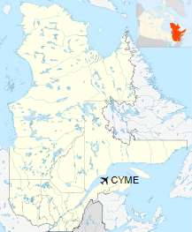
Location in Quebec
|
| Runways |
| Direction |
Length |
Surface |
| ft |
m |
09/27 |
5,500 |
1,676 |
Asphalt |
|
The above content comes from Wikipedia and is published under free licenses – click here to read more.
| General Info
|
| Country |
Canada
|
| ICAO ID |
CYME
|
| Latitude |
48.856945
48° 51' 25.00" N
|
| Longitude |
-67.453333
067° 27' 12.00" W
|
| Elevation |
102 feet
31 meters
|
| Magnetic Variation |
019° W (01/06)
|
| Operating Agency |
MUNICIPAL
|
| Communications
|
CTAF/UNICOM
Opr ltd hr.
|
122.8
|
| MONTREAL CNTR |
134.65
227.2
|
| Communications Remarks |
|
| CNTR |
(ARR/DEP svc)
|
| Runways
|
ID
|
Dimensions |
Surface |
PCN |
ILS
|
| 09/27 |
5500 x 150 feet
1676 x 46 meters |
ASPHALT |
- |
NO
|
| Navaids
|
| Type |
ID |
Name |
Channel |
Freq |
Distance From Field |
Bearing From Navaid
|
| NDB |
ME |
MATANE |
- |
216 |
4.1 NM |
090.7
|
| Supplies/Equipment
|
| Fuel |
100/130 MIL Spec, low lead, aviation gasoline (BLUE)
|
The content above was published at Airports-Worldwide.com in 2018.
We don't guarantee the information is fresh and accurate. The data may
be wrong or outdated.
For more up-to-date information please refer to other sources.
|
|


