 |
|
Lebel-sur-Quévillon Airport |
Lebel-sur-Quévillon Airport, (IATA: YLS, TC LID: CSH4) is a registered aerodrome located 3 nautical miles (5.6 km; 3.5 mi)
southwest of Lebel-sur-Quévillon, Quebec, Canada.
| Aéroport de Lebel-sur-Quévillon |
- IATA: YLS
- ICAO: none
- TC LID: CSH4
|
| Summary |
| Airport type |
Private |
| Operator |
Ville de Lebel-sur-Quévillon |
| Serves |
Lebel-sur-Quévillon |
| Location |
Lebel-sur-Quévillon, Quebec |
| Time zone |
EST (UTC−5) |
| Summer (DST) |
EDT (UTC−4) |
| Elevation AMSL |
961 ft / 293 m |
| Coordinates |
49°01′47″N
077°09′59″W |
| Map |
|
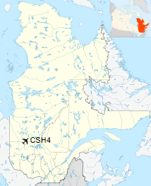
Location in Quebec
|
| Runways |
| Direction |
Length |
Surface |
| ft |
m |
15/33 |
4,212 |
1,284 |
Asphalt |
|
The above content comes from Wikipedia and is published under free licenses – click here to read more.
| General Info
|
| Country |
Canada
|
| Latitude |
49.030278
49° 01' 49.00" N
|
| Longitude |
-77.017222
077° 01' 02.00" W
|
| Elevation |
960 feet
293 meters
|
| Magnetic Variation |
014° W (01/06)
|
| Operating Agency |
MUNICIPAL
|
| Daylight Saving Time |
Second Sunday in March at 0200 to first Sunday in November at 0200 local time (Exception Arizona and that portion of Indiana in the Eastern Time Zone)
|
| Communications
|
| CTAF |
123.2
|
| Runways
|
| ID |
Dimensions |
Surface |
PCN |
ILS
|
| 15/33 |
3712 x 100 feet
1131 x 30 meters |
ASPHALT |
- |
NO
|
The content above was published at Airports-Worldwide.com in 2020.
We don't guarantee the information is fresh and accurate. The data may
be wrong or outdated.
For more up-to-date information please refer to other sources.
|
|


