La Mazaca/Mont Tremblant International Airport |
Mont-Tremblant International Airport (IATA: YTM, ICAO: CYFJ) (officially La Macaza – Mont Tremblant International and formerly Rivière Rouge – Mont Tremblant International Airport) is a single runway airport located in the township of La Macaza, about 25 nautical miles (46 km; 29 mi) north of Mont-Tremblant, Quebec, Canada.
|
La Mazaca/Mont Tremblant International Airport. |
Mont-Tremblant International Airport
Aéroport International de Mont-Tremblant
La Macaza/Mont Tremblant Intl Inc Airport |
|
|
| Summary |
| Airport type |
Private |
| Operator |
Mont-Tremblant Intl Inc |
| Serves |
Mont-Tremblant, Quebec |
| Location |
La Macaza, Quebec |
| Time zone |
EST (UTC−05:00) |
| Summer (DST) |
EDT (UTC−04:00) |
| Elevation AMSL |
825 ft / 251 m |
| Coordinates |
46°24′33″N
074°46′48″W |
| Website |
www.mtia.ca/en |
| Map |
|
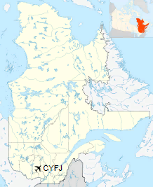
Location in Quebec
|
| Runways |
| Direction |
Length |
Surface |
| ft |
m |
03/21 |
5,902 |
1,799 |
Asphalt |
|
History
Military base
The airport was completed in 1962 for the Royal Canadian Air Force (RCAF) by Boeing to military specifications, as an RCAF emergency landing field, with a runway of 6,000 ft (1,829 m). It became home to 447 SAM Squadron, armed with 29 nuclear tipped CIM-10 Bomarc missiles. After 1968 the station became CFB La Macaza and closed as an active base in 1972 following the removal of the Bomarc missiles.
Civilian airfield
It was converted to be a civilian airport, and then turned into an international airport in 2000 despite a referendum held in the region in which the citizens of La Macaza opposed the project.
Federal prison
The area that was used for the Bomarc launchers was converted into the La Macaza Institution in 1978.
Facilities
|
La Mazaca/Mont Tremblant International Airport. |
Terminal building
The airport consists of a small chalet-style terminal building along the east side of the runway and south of the prison facility. There are no hangars for aircraft storage.
The airport is classified as an airport of entry by Nav Canada and is staffed by the Canada Border Services Agency (CBSA). CBSA officers at this airport can handle general aviation aircraft only, with no more than 15 passengers.
The airport is about a 40-minute taxi ride from the resort at Mont Tremblant in good road conditions. It can take up to an hour in winter snow conditions as part of the road is secondary pavement with many twists and turns.
The airport is served during the ski season and summer months by Porter Airlines and between December and March by Air Canada.
Airlines and destinations
| Airlines |
Destinations |
| Air Canada Express |
Seasonal: Toronto-Pearson |
| Porter Airlines |
Seasonal: Toronto-Billy Bishop |
Ground transportation
The airport has shuttle buses running from the airport to the Mont Tremblant Resort.
Rental cars, taxis and limos are available for travel around Mont Tremblant International Airport.
Expansion plans
The airport operator is planning to expand the airport services by extending the runway to 2,500 m (8,202 ft) (to allow larger jets to land), building a larger terminal (moved to the north end of the runway from the current southeast side of the runway) and adding a water aerodrome (waterside terminal for floatplanes) on the south end of Lac Chaud.
The above content comes from Wikipedia and is published under free licenses – click here to read more.
| General Info
|
| Country |
Canada
|
| ICAO ID |
CYFJ
|
| Time |
UTC-5(-4DT)
|
| Latitude |
46.409444
46° 24' 34.00" N
|
| Longitude |
-74.780000
074° 46' 48.00" W
|
| Elevation |
827 feet
252 meters
|
| Magnetic Variation |
015° W (01/06)
|
| Operating Agency |
CIVIL GOVERNMENT, (LANDING FEES AND DIPLOMATIC CLEARANCE MAY BE REQUIRED)
|
| Near City |
Riviere Rouge
|
| Operating Hours |
SUNRISE TO SUNSET (SR-SS)
|
| International Clearance Status |
Airport of Entry
|
| Daylight Saving Time |
Second Sunday in March at 0200 to first Sunday in November at 0200 local time (Exception Arizona and that portion of Indiana in the Eastern Time Zone)
|
| Communications
|
CTAF/UNICOM
UNICOM opr ltd hrs.
|
122.7
|
| Runways
|
ID
|
Dimensions |
Surface |
PCN |
ILS
|
| 03/21 |
5587 x 100 feet
1703 x 30 meters |
ASPHALT |
- |
NO
|
| Supplies/Equipment
|
| Fuel |
100/130 MIL Spec, low lead, aviation gasoline (BLUE)
|
| Remarks
|
| CAUTION |
All flt and apch maneuvers W of rwy. CYR615 sfc to 1800' E of rwy. 1450' twr 4.5NM W of arpt.
|
| FUEL |
(NC-100LL, A1)
|
| LGT |
O/R fone C819-425-7919.
|
| TFC PAT |
Rgt tfc Rwy 21.
|
The content above was published at Airports-Worldwide.com in 2018.
We don't guarantee the information is fresh and accurate. The data may
be wrong or outdated.
For more up-to-date information please refer to other sources.
|


