 |
|
Kattiniq/Donaldson Airport |
Katinniq/Donaldson Airport, (IATA: YAU, TC LID: CTP9), is located 10 nautical miles (19 km; 12 mi) east of Raglan Mine, Quebec, Canada.
| Katinniq/Donaldson Airport |
- IATA: YAU
- ICAO: none
- TC LID: CTP9
|
| Summary |
| Airport type |
Private |
| Operator |
Glencore Canada Corporation - Mine |
| Location |
Raglan Mine, Quebec |
| Time zone |
EST (UTC−05:00) |
| Summer (DST) |
EDT (UTC−04:00) |
| Elevation AMSL |
1,902 ft / 580 m |
| Coordinates |
61°39′44″N
073°19′17″W |
| Map |
|
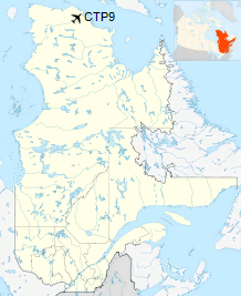
Location in Quebec
|
| Runways |
| Direction |
Length |
Surface |
| ft |
m |
11/29 |
6,500 |
1,981 |
Gravel |
|
Airlines and destinations
| Airlines |
Destinations |
| Air Inuit |
Charter: Rouyn-Noranda, Val-d'Or |
The above content comes from Wikipedia and is published under free licenses – click here to read more.
The content above was published at Airports-Worldwide.com in 2018.
We don't guarantee the information is fresh and accurate. The data may
be wrong or outdated.
For more up-to-date information please refer to other sources.
|
|


