 |
|
Îles-de-la-Madeleine Airport |
Îles-de-la-Madeleine Airport (IATA: YGR, ICAO: CYGR) (French: Aéroport des Îles-de-la-Madeleine) is located on House Harbour island in the Magdalen Islands, Quebec, Canada. Although it is almost at sea level, nearby land rises significantly to the south, prohibiting circling approaches in that direction. Sea gulls are a frequent concern when landing at Îles-de-la-Madeleine.
|
Îles-de-la-Madeleine Airport. |
The airport is classified as an airport of entry by Nav Canada and is staffed by the Canada Border Services Agency (CBSA). CBSA officers at this airport can handle general aviation aircraft only, with no more than 15 passengers.
|
Îles-de-la-Madeleine Airport
Aéroport des Îles-de-la-Madeleine |
- IATA: YGR
- ICAO: CYGR
- WMO: 71709
|
| Summary |
| Airport type |
Public |
| Operator |
Transport Canada |
| Location |
Magdalen Islands, Quebec |
| Time zone |
AST (UTC−04:00) |
| • Summer (DST) |
ADT (UTC−03:00) |
| Elevation AMSL |
35 ft / 11 m |
| Coordinates |
47°25′30″N
061°46′41″W |
| Map |
|
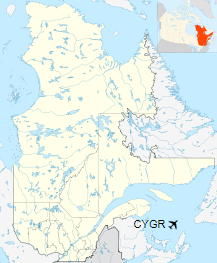
Location in Quebec
|
| Runways |
| Direction |
Length |
Surface |
| ft |
m |
07/25 |
4,493 |
1,369 |
Asphalt |
16/34 |
3,608 |
1,100 |
Asphalt |
|
| Statistics (2010) |
|
|
|
Sources: Canada Flight Supplement
Environment Canada
Movements from Statistics Canada |
|
Îles-de-la-Madeleine Airport. |
Airlines and destinations
| Airlines |
Destinations |
| Air Canada Express |
Gaspé, Montreal-Trudeau, Quebec City |
| Pascan Aviation |
Bonaventure, Mont-Joli, Montréal-Saint-Hubert, Quebec City |
| Air Saint-Pierre |
Saint-Pierre |
The airport was formerly served by Eastern Provincial Airways, Intair and Quebecair when these airlines were in operation.
|
Îles-de-la-Madeleine Airport. |
Accidents and incidents
- On March 29 2016, a Mitsubishi MU-2 turboprop crashed upon approach to the airport, killing seven people, including former federal Minister of Transport Jean Lapierre, his wife and three of his siblings.
The above content comes from Wikipedia and is published under free licenses – click here to read more.
| General Info
|
| Country |
Canada
|
| ICAO ID |
CYGR
|
| Latitude |
47.424721
47° 25' 29.00" N
|
| Longitude |
-61.778056
061° 46' 41.00" W
|
| Elevation |
35 feet
11 meters
|
| Magnetic Variation |
020° W (01/06)
|
| Beacon |
Yes
|
| Operating Agency |
CIVIL GOVERNMENT, (LANDING FEES AND DIPLOMATIC CLEARANCE MAY BE REQUIRED)
|
| Alternate Name |
HOUSE HARBOUR
|
| Daylight Saving Time |
Second Sunday in March at 0200 to first Sunday in November at 0200 local time (Exception Arizona and that portion of Indiana in the Eastern Time Zone)
|
| Communications
|
MF
Opr 1030-0330Z++.
|
123.15
|
| QUEBEC RDO |
126.7
|
MADELEINE RDO
Opr 1030-0330Z++.
|
123.15
|
| MONCTON CNTR |
134.35
|
| Communications Remarks |
|
| RCO |
(RCO)
|
| FSS |
Emerg only C418-969-4332.
|
| CNTR |
(APP DEP CON svc)(RCAG Grindstone)
|
| Runways
|
| ID |
Dimensions |
Surface |
PCN |
ILS
|
| 07/25 |
4500 x 150 feet
1372 x 46 meters |
ASPHALT |
067FAWT |
NO
|
| 16/34 |
3600 x 150 feet
1097 x 46 meters |
ASPHALT |
067FAXT |
NO
|
| Navaids
|
| Type |
ID |
Name |
Channel |
Freq |
Distance From Field |
Bearing From Navaid
|
| VOR-DME |
YGR |
GRINDSTONE |
057X |
112 |
At Field |
-
|
| NDB |
GR |
GRINDSTONE |
- |
370 |
6.0 NM |
81.7
|
| Supplies/Equipment
|
| Fuel |
Jet A1, without icing nhibitor.
100/130 MIL Spec, low lead, aviation gasoline (BLUE)
|
The content above was published at Airports-Worldwide.com in 2020.
We don't guarantee the information is fresh and accurate. The data may
be wrong or outdated.
For more up-to-date information please refer to other sources.
|
|


