 |
|
Webequie Airport, (IATA: YWP, ICAO: CYWP), is located 1 nautical mile (1.9 km; 1.2 mi) south southwest of the First Nations community of Webequie, Ontario, Canada.
| Webequie Airport |
|
|
| Summary |
| Airport type |
Public |
| Operator |
Government of Ontario |
| Location |
Webequie First Nation |
| Time zone |
EST (UTC−05:00) |
| Summer (DST) |
EDT (UTC−04:00) |
| Elevation AMSL |
685 ft / 209 m |
| Coordinates |
52°57′34″N
087°22′31″W |
| Map |
|
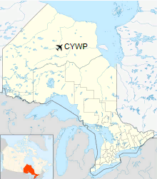
Location in Ontario
|
| Runways |
| Direction |
Length |
Surface |
| ft |
m |
02/20 |
3,507 |
1,069 |
Gravel |
|
|
Source: Canada Flight Supplement |
Airlines and destinations
| Airlines |
Destinations |
| Nakina Air Service |
Fort Hope/Eabametoong, Nakina/Greenstone, Neskantaga, Ogoki Post, Thunder Bay |
The above content comes from Wikipedia and is published under free licenses – click here to read more.
The content above was published at Airports-Worldwide.com in 2018.
We don't guarantee the information is fresh and accurate. The data may
be wrong or outdated.
For more up-to-date information please refer to other sources.
|
|


