 |
|
Wawa Airport, (IATA: YXZ, ICAO: CYXZ), is located 1.7 nautical miles (3.1 km; 2.0 mi) south southwest of Wawa, Ontario, Canada.
| Wawa Airport |
- IATA: YXZ
- ICAO: CYXZ
- WMO: 71738
|
| Summary |
| Airport type |
Public |
| Operator |
The Corporation of the Municipality of Wawa |
| Location |
Wawa, Ontario |
| Time zone |
EST (UTC−05:00) |
| Summer (DST) |
EDT (UTC−04:00) |
| Elevation AMSL |
944 ft / 288 m |
| Coordinates |
47°58′01″N
084°47′11″W |
| Map |
|
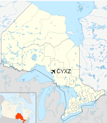
Location in Ontario
|
| Runways |
| Direction |
Length |
Surface |
| ft |
m |
03/21 |
4,429 |
1,350 |
Asphalt |
|
|
Sources: Canada Flight Supplement
Environment Canada |
The above content comes from Wikipedia and is published under free licenses – click here to read more.
| General Info
|
| Country |
Canada
|
| ICAO ID |
CYXZ
|
| Latitude |
47.966667
47° 58' 00.00" N
|
| Longitude |
-84.786667
084° 47' 12.00" W
|
| Elevation |
942 feet
287 meters
|
| Magnetic Variation |
007° W (01/06)
|
| Beacon |
Yes
|
| Operating Agency |
MUNICIPAL
|
| Daylight Saving Time |
Second Sunday in March at 0200 to first Sunday in November at 0200 local time (Exception Arizona and that portion of Indiana in the Eastern Time Zone)
|
| Communications
|
CTAF/UNICOM
UNICOM opr ltd hr.
|
122.8
|
| LONDON RDO |
126.7
|
| TORONTO CNTR |
124.075
298.6
|
| Communications Remarks |
|
| RCO |
(RCO)
|
| CNTR |
(APP DEP svc)
|
| Runways
|
ID
|
Dimensions |
Surface |
PCN |
ILS
|
| 03/21 |
4429 x 100 feet
1350 x 30 meters |
ASPHALT |
- |
NO
|
| Navaids
|
| Type |
ID |
Name |
Channel |
Freq |
Distance From Field |
Bearing From Navaid
|
| VOR-DME |
YXZ |
WAWA |
074X |
112.7 |
1.8 NM |
063.3
|
| NDB |
XZ |
WAWA |
- |
205 |
3.7 NM |
213.2
|
| Supplies/Equipment
|
| Fuel |
Jet A1, without icing nhibitor.
100/130 MIL Spec, low lead, aviation gasoline (BLUE)
|
The content above was published at Airports-Worldwide.com in 2018.
We don't guarantee the information is fresh and accurate. The data may
be wrong or outdated.
For more up-to-date information please refer to other sources.
|
|


