Tyendinaga (Mohawk) Airport |
Tyendinaga (Mohawk) Airport (TC LID: CPU6) is a registered aerodrome that is open to the public and caters mainly to general aviation. The aerodrome is located in Tyendinaga Mohawk Territory, 3 nautical miles (5.6 km; 3.5 mi) southwest of Tyendinaga, Ontario, Canada, north of the Bay of Quinte between Kingston and Belleville.
| Tyendinaga (Mohawk) Airport |
- IATA: none
- ICAO: none
- TC LID: CPU6
|
| Summary |
| Airport type |
Public |
| Operator |
First Nations Technical Institute |
| Location |
Tyendinaga Mohawk Territory, Ontario |
| Time zone |
EST (UTC−05:00) |
| Summer (DST) |
EDT (UTC−04:00) |
| Elevation AMSL |
260 ft / 79 m |
| Coordinates |
44°11′05″N
077°06′28″W |
| Map |
|
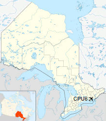
Location in Ontario
|
| Runways |
| Direction |
Length |
Surface |
| ft |
m |
09/27 |
4,270 |
1,301 |
Asphalt |
15/33 |
2,575 |
785 |
Asphalt |
|
|
Source: Canada Flight Supplement |
History
Originally known as Deseronto Airport, the field opened in 1917 as a training school for pilots during World War I. During World War II, it hosted the No. 1 Instrument Navigation School for the British Commonwealth Air Training Plan, providing advanced instrument-navigation training to air crews.
The aerodrome is currently the site of the First Nations Technical Institute and the First Nations Flying School.
The above content comes from Wikipedia and is published under free licenses – click here to read more.
The content above was published at Airports-Worldwide.com in 2018.
We don't guarantee the information is fresh and accurate. The data may
be wrong or outdated.
For more up-to-date information please refer to other sources.
|


