 |
|
Marathon Aerodrome, (IATA: YSP, ICAO: CYSP), is located 2.6 nautical miles (4.8 km; 3.0 mi) northeast of Marathon, Ontario, Canada.
| Marathon Aerodrome |
|
|
| Summary |
| Airport type |
Public |
| Operator |
Corporation of the Town of Marathon |
| Location |
Marathon, Ontario |
| Time zone |
EST (UTC−05:00) |
| Summer (DST) |
EDT (UTC−04:00) |
| Elevation AMSL |
1,032 ft / 315 m |
| Coordinates |
48°45′26″N
086°20′45″W |
| Map |
|
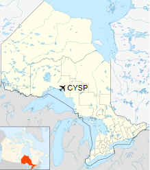
Location in Ontario |
| Runways |
| Direction |
Length |
Surface |
| ft |
m |
16/34 |
3,933 |
1,199 |
Asphalt |
|
|
Sources: Canada Flight Supplement |
The above content comes from Wikipedia and is published under free licenses – click here to read more.
| General Info
|
| Country |
Canada
|
| ICAO ID |
CYSP
|
| Latitude |
48.755278
48° 45' 19.00" N
|
| Longitude |
-86.344444
086° 20' 40.00" W
|
| Elevation |
1035 feet
315 meters
|
| Magnetic Variation |
006° W (01/06)
|
| Operating Agency |
MUNICIPAL
|
| Daylight Saving Time |
Second Sunday in March at 0200 to first Sunday in November at 0200 local time (Exception Arizona and that portion of Indiana in the Eastern Time Zone)
|
| Communications
|
CTAF/UNICOM
UNICOM OPS LTD HRS, OT TFC 122.8.
|
122.8
|
| WINNIPEG RDO |
123.55
|
| WINNIPEG CNTR |
134.075
235.0
|
| Communications Remarks |
|
| RCO |
(123.55 GCO.Key 4 times)
|
| CNTR |
(RCAG at the afld)
|
| Runways
|
ID
|
Dimensions |
Surface |
PCN |
ILS
|
| 16/34 |
3933 x 100 feet
1199 x 30 meters |
ASPHALT |
- |
NO
|
| Navaids
|
| Type |
ID |
Name |
Channel |
Freq |
Distance From Field |
Bearing From Navaid
|
| VOR-DME |
YSP |
MARATHON |
106X |
115.9 |
1.0 NM |
322.8
|
| Supplies/Equipment
|
| Fuel |
Jet A1, without icing nhibitor.
100/130 MIL Spec, low lead, aviation gasoline (BLUE)
|
The content above was published at Airports-Worldwide.com in 2018.
We don't guarantee the information is fresh and accurate. The data may
be wrong or outdated.
For more up-to-date information please refer to other sources.
|
|


