 |
|
Manitouwadge Airport, (IATA: YMG, ICAO: CYMG), is located 2.8 nautical miles (5.2 km; 3.2 mi) southwest of Manitouwadge, Ontario, Canada.
| Manitouwadge Airport |
|
|
| Summary |
| Airport type |
Public |
| Owner |
Township of Manitouwadge |
| Operator |
Township of Manitouwadge |
| Serves |
Manitouwadge, Ontario |
| Location |
Manitouwadge, Ontario |
| Time zone |
EST (UTC−05:00) |
| Summer (DST) |
EDT (UTC−04:00) |
| Elevation AMSL |
1,199 ft / 365 m |
| Coordinates |
49°05′00″N
085°51′40″W |
| Website |
www.manitouwadge.ca/?pgid=18 |
| Map |
|
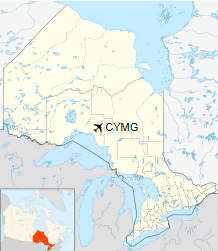
Location in Ontario
|
| Runways |
| Direction |
Length |
Surface |
| ft |
m |
05/23 |
3,603 |
1,098 |
Asphalt |
|
The above content comes from Wikipedia and is published under free licenses – click here to read more.
| General Info
|
| Country |
Canada
|
| ICAO ID |
CYMG
|
| Latitude |
49.083889
49° 05' 02.00" N
|
| Longitude |
-85.860556
085° 51' 38.00" W
|
| Elevation |
1198 feet
365 meters
|
| Magnetic Variation |
007° W (01/06)
|
| Beacon |
Yes
|
| Operating Agency |
MUNICIPAL
|
| Daylight Saving Time |
Second Sunday in March at 0200 to first Sunday in November at 0200 local time (Exception Arizona and that portion of Indiana in the Eastern Time Zone)
|
| Communications
|
CTAF/UNICOM
UNICOM opr ltd hr.
|
122.8
|
| LONDON RDO |
126.7
|
| Communications Remarks |
|
| A/D |
(RCO)(APP DEP svc)
|
| Runways
|
ID
|
Dimensions |
Surface |
PCN |
ILS
|
| 05/23 |
3600 x 100 feet
1097 x 30 meters |
ASPHALT |
- |
NO
|
| Navaids
|
| Type |
ID |
Name |
Channel |
Freq |
Distance From Field |
Bearing From Navaid
|
| NDB |
YMG |
MANITOUWADGE |
- |
219 |
2.6 NM |
043.7
|
| Supplies/Equipment
|
| Fuel |
Jet B, Wide cut turbine fuel, Without icing inhibitor.
|
The content above was published at Airports-Worldwide.com in 2018.
We don't guarantee the information is fresh and accurate. The data may
be wrong or outdated.
For more up-to-date information please refer to other sources.
|
|


