 |
|
Kincardine Municipal Airport |
Kincardine Airport (IATA: YKD, ICAO: CYKM) is located 1.5 nautical miles (2.8 km; 1.7 mi) north-northeast of Kincardine, Ontario, Canada.
Kincardine Municipal Airport is a Transport Canada registered aerodrome north of the town of Kincardine on Highway 21.
|
Kincardine Municipal Airport. |
The airport complex occupies 120 acres (49 ha), overlooking Lake Huron. It serves as a base for sightseeing, corporate jets, air ambulance services and recreational pilots, some of whom own private hangars on the airport grounds. There are two paved runways with a full ARCAL system along with NDB/DME and GPS LPV approaches.
| Kincardine Municipal Airport |
|

|
|
|
| Summary |
| Airport type |
Public |
| Operator |
Municipality of Kincardine |
| Location |
Kincardine, Ontario |
| Time zone |
EST (UTC−05:00) |
| Summer (DST) |
EDT (UTC−04:00) |
| Elevation AMSL |
772 ft / 235 m |
| Coordinates |
44°12′05″N
081°36′20″W |
| Website |
www.kincardineairport.ca |
| Map |
|
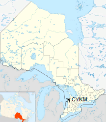
Location in Ontario
|
| Runways |
| Direction |
Length |
Surface |
| ft |
m |
05/23 |
2,083 |
635 |
Asphalt |
13/31 |
4,085 |
1,245 |
Asphalt |
|
|
Kincardine Municipal Airport. |
The above content comes from Wikipedia and is published under free licenses – click here to read more.
| General Info
|
| Country |
Canada
|
| Time |
UTC-5(-4DT)
|
| Latitude |
44.201389
44° 12' 05.00" N
|
| Longitude |
-81.606667
081° 36' 24.00" W
|
| Elevation |
772 feet
235 meters
|
| Magnetic Variation |
009° W (01/06)
|
| Beacon |
Yes
|
| Operating Agency |
CIVIL GOVERNMENT, (LANDING FEES AND DIPLOMATIC CLEARANCE MAY BE REQUIRED)
|
| Operating Hours |
24 HOUR OPERATIONS
|
| Daylight Saving Time |
Second Sunday in March at 0200 to first Sunday in November at 0200 local time (Exception Arizona and that portion of Indiana in the Eastern Time Zone)
|
| Communications
|
CTAF/UNICOM
UNICOM opr ltd hr.
|
122.8
|
| Runways
|
ID
|
Dimensions |
Surface |
PCN |
ILS
|
| 05/23 |
2087 x 50 feet
636 x 15 meters |
ASPHALT |
- |
NO
|
| 13/31 |
4085 x 75 feet
1245 x 23 meters |
ASPHALT |
- |
NO
|
| Navaids
|
| Type |
ID |
Name |
Channel |
Freq |
Distance From Field |
Bearing From Navaid
|
| NDB |
D7 |
KINCARDINE |
- |
350 |
At Field |
-
|
| Supplies/Equipment
|
| Fuel |
Jet A1, without icing nhibitor.
80/87 octane gasoline, leaded, MIL-L-5572F (RED)
100/130 MIL Spec, low lead, aviation gasoline (BLUE)
|
| Remarks
|
| FUEL |
(NC-80, 100LL, A1+)
|
| LGT |
ACTIVATE-MIRL Rwy 05-23 and MIRL, PAPI Rwy 13-31-CTAF. PAPI Rwy 13-31, 12 lgt unit for acft with eye-to-wheel hgt up to 10'.
|
The content above was published at Airports-Worldwide.com in 2018.
We don't guarantee the information is fresh and accurate. The data may
be wrong or outdated.
For more up-to-date information please refer to other sources.
|
|


