 |
|
Fort Severn Airport, (IATA: YER, ICAO: CYER), is located 3 nautical miles (5.6 km; 3.5 mi) northwest of Fort Severn First Nation, Ontario, Canada. It is served by Wasaya Airways with connections to Sioux Lookout and Big Trout Lake.
| Fort Severn Airport |
- IATA: YER
- ICAO: CYER
- WMO: 71099
|
| Summary |
| Airport type |
Public |
| Operator |
Government of Ontario |
| Location |
Fort Severn First Nation |
| Time zone |
EST (UTC−05:00) |
| Summer (DST) |
EDT (UTC−04:00) |
| Elevation AMSL |
52 ft / 16 m |
| Coordinates |
56°01′08″N
087°40′34″W |
| Map |
|
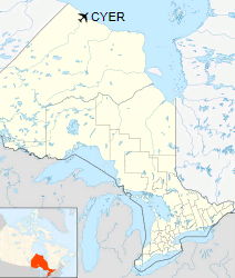
Location in Ontario
|
| Runways |
| Direction |
Length |
Surface |
| ft |
m |
15/33 |
3,518 |
1,072 |
Gravel |
|
|
Sources: Canada Flight Supplement
Environment Canada |
Accidents and incidents
- On 25 September 1975, Douglas C-47A CF-AII of Ilford-Riverton Airways crashed short of the runway, killing all three people on board. The aircraft was operating a non-scheduled passenger flight.
The above content comes from Wikipedia and is published under free licenses – click here to read more.
The content above was published at Airports-Worldwide.com in 2018.
We don't guarantee the information is fresh and accurate. The data may
be wrong or outdated.
For more up-to-date information please refer to other sources.
|
|


