 |
|
Dryden Regional Airport, (IATA: YHD, ICAO: CYHD), is located 4.3 nautical miles (8.0 km; 4.9 mi) northeast of Dryden, Ontario, Canada.
| Dryden Regional Airport |
- IATA: YHD
- ICAO: CYHD
- WMO: 71527
|
| Summary |
| Airport type |
Public |
| Operator |
City of Dryden |
| Location |
Dryden, Ontario |
| Time zone |
CST (UTC−06:00) |
| Summer (DST) |
CDT (UTC−05:00) |
| Elevation AMSL |
1,354 ft / 413 m |
| Coordinates |
49°49′53″N
092°44′37″W |
| Website |
http://cyhd.ca/ |
| Map |
|
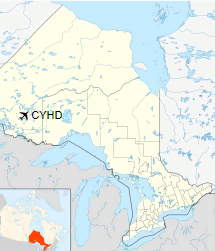
Location in Ontario
|
| Runways |
| Direction |
Length |
Surface |
| ft |
m |
06/24 |
2,000 |
610 |
Sand |
12/30 |
5,996 |
1,828 |
Asphalt |
|
| Statistics (2010) |
| Aircraft movements |
12,709 |
|
|
Source: Canada Flight Supplement
Environment Canada
Movements from Statistics Canada. |
Airlines and destinations
| Airlines |
Destinations |
| Bearskin Airlines |
Fort Frances, Kenora, Red Lake, Sioux Lookout, Thunder Bay, Winnipeg |
Accidents and incidents
- On March 10, 1989, Air Ontario Flight 1363, a Fokker F28-1000 Fellowship, crashed shortly after takeoff due to ice on the wings. 21 of the 65 people on board perished.
The above content comes from Wikipedia and is published under free licenses – click here to read more.
| General Info
|
| Country |
Canada
|
| ICAO ID |
CYHD
|
| Latitude |
49.831667
49° 49' 54.00" N
|
| Longitude |
-92.744167
092° 44' 39.00" W
|
| Elevation |
1354 feet
413 meters
|
| Type |
Civil
|
| Magnetic Variation |
000° W (01/06)
|
| Beacon |
Yes
|
| Operating Agency |
MUNICIPAL
|
| Daylight Saving Time |
Second Sunday in March at 0200 to first Sunday in November at 0200 local time (Exception Arizona and that portion of Indiana in the Eastern Time Zone)
|
| Communications
|
| MF |
122.1
|
| WINNIPEG RDO |
122.1
|
| WINNIPEG CNTR |
132.2
245.0
|
| MIN NATL RESOURCES |
122.9
|
| Communications Remarks |
|
| RCO |
(RCO)
|
| CNTR |
(ARR DEP CON svc)
|
| Runways
|
ID
|
Dimensions |
Surface |
PCN |
ILS
|
| 05/23 |
2000 x 75 feet
610 x 23 meters |
SAND, GRADED, ROLLED OR OILED. |
- |
NO
|
| 11/29 |
6000 x 150 feet
1829 x 46 meters |
ASPHALT |
067FAYT |
NO
|
| Navaids
|
| Type |
ID |
Name |
Channel |
Freq |
Distance From Field |
Bearing From Navaid
|
| NDB |
ZHD |
BARCLAY |
- |
399 |
4.3 NM |
295.0
|
| DME |
IHD |
DRYDEN REGIONAL |
034X |
- |
At Field |
-
|
| Supplies/Equipment
|
| Fuel |
Jet B, Wide cut turbine fuel, Without icing inhibitor.
100/130 MIL Spec, low lead, aviation gasoline (BLUE)
|
The content above was published at Airports-Worldwide.com in 2018.
We don't guarantee the information is fresh and accurate. The data may
be wrong or outdated.
For more up-to-date information please refer to other sources.
|
|


