 |
|
Brantford Airport (ICAO: CYFD), also known as Brantford Municipal Airport, is a registered aerodrome located 4 nautical miles (7.4 km; 4.6 mi) west southwest of the City of Brantford, in the county of Brant, Ontario, Canada. There is a single fixed-base operator at the airport. The airport hosts a widely attended air show every year at the end of August, featuring the Royal Canadian Air Force aerobatic team the Snowbirds and airplanes from the Canadian Warplane Heritage Museum. The airport is home to many of the area's general aviation aircraft. Aviation spare parts retailer Aircraft Spruce established its sole Canadian location here in 2008, with expansion plans announced in 2013. The airport is often used for film shoots; scenes from Welcome to Mooseport, Where The Truth Lies and multiple Mayday episodes have been filmed there.
Although the airport has never had scheduled air service, weekly charters fly students of the W. Ross Macdonald School home to Sudbury, Timmins, Trenton, Ottawa and Sault Ste. Marie.
The airport is classified as an airport of entry by Nav Canada and is staffed by the Canada Border Services Agency (CBSA). The CBSA officers at this airport currently can handle general aviation aircraft only, with no more than 15 passengers.
Brantford Airport
Brantford Municipal Airport |
|
|
| Summary |
| Airport type |
Public |
| Owner/Operator |
City of Brantford |
| Serves |
Brantford, Ontario |
| Location |
Brantford, Ontario |
| Time zone |
EST (UTC−05:00) |
| Summer (DST) |
EDT (UTC−04:00) |
| Elevation AMSL |
815 ft / 248 m |
| Coordinates |
43°07′57″N
080°20′29″W |
| Website |
www.BrantfordAirport.ca |
| Map |
|
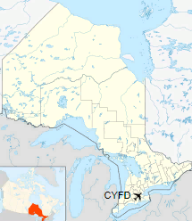
Location in Ontario
|
| Runways |
| Direction |
Length |
Surface |
| ft |
m |
05/23 |
5,036 |
1,535 |
Asphalt |
11/29 |
2,626 |
800 |
Asphalt |
17/35 |
2,626 |
800 |
Asphalt |
|
History
A public aerodrome was established at Brantford in 1929 (located at Fairview and King George streets). The airport opened at its present location on 11 November 1940 as No. 5 Service Flying Training School, a Royal Canadian Air Force British Commonwealth Air Training Plan airfield.
It wasn't until 27 April 1970 that aerodrome lands and management duty were transferred from the federal government to the municipal level. The current terminal building was built in 1966. The City of Brantford once looked at the possibility of closing the airport, but this move was widely opposed by local citizens, tenants and users. In May 2007, Brantford City Council held a public forum to canvass views on the airport as an essential/necessary Service for the city. Many presentations made clear points that growing cities require airports as part of their fundamental infrastructure, to attract and retain corporate investment. In January 2008, Brantford City Council voted unanimously to support the inclusion of $1.9 million in planned airport infrastructure upgrades in the city's Capital Plan for Fiscal 2008. This allowed for repaving the main runway, plus a second runway that was last paved in the 1940s. In 2004, 2009 and 2011, new rows of hangars were built, with plans for more in the future. In August 2014, an experimental aircraft crashed near the airport. Early the next month, a small aircraft crashed while on approach to the airport, killing one pilot. On April 27, 2016, a Cessna 182 flipped over on the runway, injuring one pilot.
The above content comes from Wikipedia and is published under free licenses – click here to read more.
| General Info
|
| Country |
Canada
|
| ICAO ID |
CYFD
|
| Time |
UTC-5(-4DT)
|
| Latitude |
43.131390
43° 07' 53.00" N
|
| Longitude |
-80.342499
080° 20' 33.00" W
|
| Elevation |
815 feet
248 meters
|
| Type |
Civil
|
| Magnetic Variation |
009° W (02/06)
|
| Beacon |
Yes
|
| Operating Agency |
CIVIL GOVERNMENT, (LANDING FEES AND DIPLOMATIC CLEARANCE MAY BE REQUIRED)
|
| Operating Hours |
24 HOUR OPERATIONS
|
| International Clearance Status |
Airport of Entry
|
| Daylight Saving Time |
Second Sunday in March at 0200 to first Sunday in November at 0200 local time (Exception Arizona and that portion of Indiana in the Eastern Time Zone)
|
| Communications
|
CTAF/UNICOM
UNICOM opr ltd hr.
|
122.825
|
| TORONTO TRML |
128.27
|
| Communications Remarks |
|
| A/D |
(APP/DEP svc)
|
| Runways
|
ID
|
Dimensions |
Surface |
PCN |
ILS
|
| 05/23 |
5000 x 100 feet
1524 x 30 meters |
ASPHALT |
- |
NO
|
| 11/29 |
2600 x 100 feet
792 x 30 meters |
ASPHALT |
- |
NO
|
| 17/35 |
2600 x 100 feet
792 x 30 meters |
ASPHALT |
- |
NO
|
| Navaids
|
| Type |
ID |
Name |
Channel |
Freq |
Distance From Field |
Bearing From Navaid
|
| NDB |
FD |
BRANTFORD |
- |
207 |
4.8 NM |
052.4
|
| Supplies/Equipment
|
| Fuel |
Jet A1+, Jet A1 with icing inhibitor.
100/130 MIL Spec, low lead, aviation gasoline (BLUE)
|
| Remarks
|
| FUEL |
(NC-100LL, A1+)
|
| LGT |
ACTIVATE-MIRL, REIL, VASI Rwy 05-23-CTAF. VASI Rwy 05-23 9 lgt unit for acft with eye-to-wheel hgt up to 10'.
|
| MISC |
No win maint Twy C, D, E.
|
| RSTD |
Twy C, D, E, day use only.
|
The content above was published at Airports-Worldwide.com in 2018.
We don't guarantee the information is fresh and accurate. The data may
be wrong or outdated.
For more up-to-date information please refer to other sources.
|
|


