 |
|
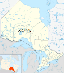
Armstrong Airport, (IATA: YYW, ICAO: CYYW), is located 4.5 nautical miles (8.3 km; 5.2 mi) east southeast of Armstrong, Thunder Bay District, Ontario, Canada.
| Armstrong Airport |
|
|
| Summary |
| Airport type |
Public |
| Operator |
Government of Ontario |
| Location |
Armstrong, Thunder Bay District, Ontario |
| Time zone |
EST (UTC−05:00) |
| Summer (DST) |
EDT (UTC−04:00) |
| Elevation AMSL |
1,059 ft / 323 m |
| Coordinates |
50°17′38″N
088°54′36″W |
| Map |
|
Location in Ontario
|
| Runways |
| Direction |
Length |
Surface |
| ft |
m |
12/30 |
4,006 |
1,221 |
Asphalt |
|
The above content comes from Wikipedia and is published under free licenses – click here to read more.
| General Info
|
| Country |
Canada
|
| ICAO ID |
CYYW
|
| Latitude |
50.290279
50° 17' 25.00" N
|
| Longitude |
-88.909721
088° 54' 35.00" W
|
| Elevation |
1058 feet
322 meters
|
| Magnetic Variation |
004° W (01/06)
|
| Operating Agency |
CIVIL GOVERNMENT, (LANDING FEES AND DIPLOMATIC CLEARANCE MAY BE REQUIRED)
|
| Daylight Saving Time |
Second Sunday in March at 0200 to first Sunday in November at 0200 local time (Exception Arizona and that portion of Indiana in the Eastern Time Zone)
|
| Communications
|
| CTAF |
122.8
|
| Runways
|
ID
|
Dimensions |
Surface |
PCN |
ILS
|
| 12/30 |
4000 x 100 feet
1219 x 30 meters |
ASPHALT |
- |
NO
|
| 18/36 |
2940 x 100 feet
896 x 30 meters |
ASPHALT |
- |
NO
|
| Navaids
|
| Type |
ID |
Name |
Channel |
Freq |
Distance From Field |
Bearing From Navaid
|
| NDB |
YYW |
ARMSTRONG |
- |
223 |
4.5 NM |
107.4
|
The content above was published at Airports-Worldwide.com in 2018.
We don't guarantee the information is fresh and accurate. The data may
be wrong or outdated.
For more up-to-date information please refer to other sources.
|
|


