 |
|
Rankin Inlet Airport (IATA: YRT, ICAO: CYRT) is located at Rankin Inlet, Nunavut, Canada,
and is operated by the government of Nunavut.
In December 2005 the Government of Nunavut announced that they would spend $3 million to
improve the Instrument Landing System and expand the apron.
Canadian NORAD Region Forward Operating Location Rankin Inlet
is located on the southwest side of the runway and shares the use of the runway when operations necessitate.
|
Rankin Inlet Airport |
- IATA: YRT
- ICAO: CYRT
- WMO: 71083
|
| Summary |
| Airport type |
Public |
| Operator |
Government of Nunavut |
| Location |
Rankin Inlet, Nunavut |
| Time zone |
CST (UTC−06:00) |
| • Summer (DST) |
CDT (UTC−05:00) |
| Elevation AMSL |
106 ft / 32 m |
| Coordinates |
">62°48′38″N
092°06′53″W |
| Map |
|
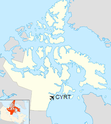
Location in Nunavut
|
| Runways |
| Direction |
Length |
Surface |
| ft |
m |
13/31 |
6,000 |
1,829 |
Asphalt |
|
| Statistics (2010) |
| Aircraft movements |
13,071 |
|
|
Sources: Canada Flight Supplement
Environment Canada
Movements from Statistics Canada |
The DND Forward Operating Location hangars for CF-18's in Rankin Inlet
Airlines and destinations
| Airlines |
Destinations |
| Calm Air |
Arviat, Baker Lake, Chesterfield Inlet, Coral Harbour, Repulse Bay, Whale Cove |
Calm Air
operated by First Air |
Churchill, Winnipeg |
| Canadian North |
Cape Dorset, Iqaluit, Yellowknife |
| First Air |
Iqaluit, Yellowknife |
| Nolinor Aviation |
Mirabel, Val d'Or |
The above content comes from Wikipedia and is published under free licenses – click here to read more.
| General Info
|
| Country |
Canada
|
| ICAO ID |
CYRT
|
| Latitude |
62.811390
62° 48' 41.00" N
|
| Longitude |
-92.115833
092° 06' 57.00" W
|
| Elevation |
94 feet
29 meters
|
| Magnetic Variation |
007° W (01/06)
|
| Beacon |
Yes
|
| Operating Agency |
CIVIL GOVERNMENT, (LANDING FEES AND DIPLOMATIC CLEARANCE MAY BE REQUIRED)
|
| Daylight Saving Time |
Second Sunday in March at 0200 to first Sunday in November at 0200 local time (Exception Arizona and that portion of Indiana in the Eastern Time Zone)
|
| Communications
|
| RDO |
122.2
|
| ARCTIC RDO |
126.7
|
| VDF |
122.2
|
| MF RDO |
122.2
|
| Communications Remarks |
|
| RDO |
Emerg only C867-645-2672
|
| RCO |
(North Bay RCO). Freq's 122.2 is also used for direction finding.
|
| Runways
|
ID
|
Dimensions |
Surface |
PCN |
ILS
|
| 13T/31T |
6000 x 150 feet
1829 x 46 meters |
ASPHALT |
035FBYU |
NO
|
| Navaids
|
| Type |
ID |
Name |
Channel |
Freq |
Distance From Field |
Bearing From Navaid
|
| VOR-DME |
YRT |
RANKIN INLET |
071X |
112.4 |
At Field |
-
|
| NDB |
RT |
RANKIN INLET |
- |
284 |
At Field |
-
|
| Supplies/Equipment
|
| Fuel |
Jet A, without icing inhibitor.
JP-8, SemiKeroscene MIL Spec T-83133, without icing inhibitor
100/130 MIL Spec, low lead, aviation gasoline (BLUE)
|
The content above was published at Airports-Worldwide.com in 2019.
We don't guarantee the information is fresh and accurate. The data may
be wrong or outdated.
For more up-to-date information please refer to other sources.
|
|


