 |
|
Qikiqtarjuaq Airport (IATA: YVM, ICAO: CYVM) is located at Qikiqtarjuaq, Nunavut, Canada, and is operated by the government of Nunavut.
This airport is a popular stop for pilots ferrying turboprop aircraft between Canada and Europe. It is considerably closer to Greenland (Sondre Stromfjord, BGSF, 767 km) than is Iqaluit (CYFB, 2912 km). Jet fuel is available from the airport fuel supplier. Avgas may be available from the town council, but this needs to be confirmed in advance.
One instrument approach is available, an NDB or GNSS circling approach. Approach minimums are higher than average (2,000 feet MSL, 1,982 AGL) due to high terrain in the area. The runway is listed as gravel-surfaced, but is in fact a mixture of very firmly packed fine sand and gravel that has a surface texture similar to asphalt. A large overnight parking area is available, but crew must bring their own tiedown anchors.
Qikiqtarjuaq is the destination of the eponymous episode of Cabin Pressure, a BBC radio sit-com set in a one-aircraft airline.
|
Qikiqtarjuaq Airport |
- IATA: YVM
- ICAO: CYVM
- WMO: 71338
|
| Summary |
| Airport type |
Public |
| Operator |
Government of Nunavut |
| Location |
Qikiqtarjuaq, Nunavut |
| Time zone |
EST (UTC−05:00) |
| • Summer (DST) |
EDT (UTC−04:00) |
| Elevation AMSL |
18 ft / 5 m |
| Coordinates |
67°32′48″N
64°01′54″W |
| Map |
|
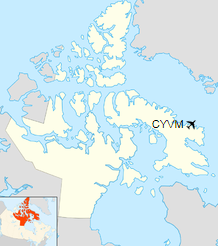
Location in Nunavut
|
| Runways |
| Direction |
Length |
Surface |
| ft |
m |
03/21 |
3,803 |
1,159 |
Gravel |
|
| Statistics (2010) |
|
|
|
Sources: Canada Flight Supplement
Environment Canada
Movements from Statistics Canada. |
Airlines and destinations
| Airlines |
Destinations |
| Canadian North |
Iqaluit, Pangnirtung |
| First Air |
Iqaluit, Pangnirtung |
The above content comes from Wikipedia and is published under free licenses – click here to read more.
| General Info
|
| Country |
Canada
|
| ICAO ID |
CYVM
|
| Latitude |
67.545833
67° 32' 45.00" N
|
| Longitude |
-64.031389
064° 01' 53.00" W
|
| Elevation |
21 feet
6 meters
|
| Magnetic Variation |
038° W (01/06)
|
| Beacon |
Yes
|
| Operating Agency |
CIVIL GOVERNMENT, (LANDING FEES AND DIPLOMATIC CLEARANCE MAY BE REQUIRED)
|
| Daylight Saving Time |
Second Sunday in March at 0200 to first Sunday in November at 0200 local time (Exception Arizona and that portion of Indiana in the Eastern Time Zone)
|
| Communications
|
BROUGHTON RDO
Opr 11-21Z++ Mon, Wed;13-23Z++ Tue; 14-23Z++ Thu, 13-22Z Fri, Sat; 11-18Z++ Sun.
|
122.1
|
CTAF
TIMES OTHER THAN RADIO SCHEDULE.
|
122.1
|
| AWOS |
122.55
|
| Runways
|
ID
|
Dimensions |
Surface |
PCN |
ILS
|
| 03T/21T |
3800 x 100 feet
1158 x 30 meters |
GRAVEL. |
- |
NO
|
| Navaids
|
| Type |
ID |
Name |
Channel |
Freq |
Distance From Field |
Bearing From Navaid
|
| NDB |
YJI |
BROUGHTON |
- |
237 |
At Field |
-
|
| Supplies/Equipment
|
| Fuel |
Jet A1, without icing nhibitor.
|
The content above was published at Airports-Worldwide.com in 2019.
We don't guarantee the information is fresh and accurate. The data may
be wrong or outdated.
For more up-to-date information please refer to other sources.
|
|


