 |
|
Gjoa Haven Airport (IATA: YHK, ICAO: CYHK) is located 1.5 nautical miles (2.8 km; 1.7 mi) southwest of Gjoa Haven, Nunavut, Canada,
and is operated by the government of Nunavut.
The airport is a single storey building and located next to several trailers. The runway and taxiways are gravel or dirt.
The runway is not marked and other than a NDB lacks navigation aids.
|
Gjoa Haven Airport |
- IATA: YHK
- ICAO: CYHK
- WMO: 71363
|
| Summary |
| Airport type |
Public |
| Operator |
Government of Nunavut |
| Location |
Gjoa Haven, Nunavut |
| Time zone |
MST (UTC−07:00) |
| • Summer (DST) |
MDT (UTC−06:00) |
| Elevation AMSL |
154 ft / 47 m |
| Coordinates |
68°38′08″N
095°51′01″W |
| Map |
|
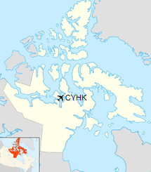
Location in Nunavut
|
| Runways |
| Direction |
Length |
Surface |
| ft |
m |
13/31 |
4,400 |
1,341 |
Gravel |
|
| Statistics (2010) |
|
|
|
Sources: Canada Flight Supplement
Environment Canada
Movements from Statistics Canada |
Airlines and destinations
| Airlines |
Destinations |
| Canadian North |
Cambridge Bay, Kugaaruk, Kugluktuk, Taloyoak, Yellowknife |
| First Air |
Cambridge Bay, Kugaaruk, Taloyoak, Yellowknife |
The above content comes from Wikipedia and is published under free licenses – click here to read more.
The content above was published at Airports-Worldwide.com in 2019.
We don't guarantee the information is fresh and accurate. The data may
be wrong or outdated.
For more up-to-date information please refer to other sources.
|
|


