 |
|
Alert Airport (IATA: YLT, ICAO: CYLT) is located at Alert, Nunavut, Canada, approximately 830 km (520 mi)
south of the true North Pole. It is operated by the Canadian Department of National Defence and is part of Canadian Forces Station Alert.
A weather station was established on the site in 1950, and in 1957 construction began on the military facilities which are still in use to this day.
It is the northernmost airport in the world.
|
Alert Airport |
- IATA: YLT
- ICAO: CYLT
- WMO: 71355
|
| Summary |
| Airport type |
Military |
| Operator |
DND / 1CdnAirDiv Alert
AMO Ottawa |
| Location |
Alert, Nunavut |
| Time zone |
EST (UTC−05:00) |
| • Summer (DST) |
EDT (UTC−04:00) |
| Elevation AMSL |
100 ft / 30 m |
| Coordinates |
82°31′04″N
062°16′50″W |
| Map |
|
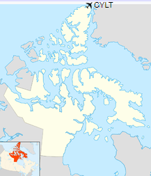
Location in Nunavut
|
| Runways |
| Direction |
Length |
Surface |
| ft |
m |
05/23 |
5,500 |
1,676 |
Ice (covered with snow most of the year) |
|
|
Source: Canada Flight Supplement
Environment Canada |
Facilities
Radar and navigation equipment are trailer units that can be moved around the airport.
The airport's fire and rescue operations are supported by a 2012 KME/Fort Garry Fire Truck ARFF.
Two bulldozers are used to grade the runway when needed.
Incidents
There have been two crashes involving fatalities at the airfield since it was established.
- July 31, 1950 – Royal Canadian Air Force Avro Lancaster AG-965 on a re-supply flight crashed, killing all 9 on board (crew members and passengers).
- October 30, 1991 – "Boxtop 22", a Lockheed C-130 Hercules from Trenton on re-supply mission crashed, killing 5 on board.
The above content comes from Wikipedia and is published under free licenses – click here to read more.
| General Info
|
| Country |
Canada
|
| ICAO ID |
CYLT
|
| Latitude |
82.517778
82° 31' 04.00" N
|
| Longitude |
-62.280556
062° 16' 50.00" W
|
| Elevation |
100 feet
30 meters
|
| Type |
Military
|
| Magnetic Variation |
061° W (07/06)
|
| Operating Agency |
MILITARY
|
| Daylight Saving Time |
Second Sunday in March at 0200 to first Sunday in November at 0200 local time (Exception Arizona and that portion of Indiana in the Eastern Time Zone)
|
| Communications
|
| OPS |
5680
6706
11232
126.7
|
| Communications Remarks |
|
| OPS |
From Resolute or Thule 3 hours prior PNR.
|
| Runways
|
ID
|
Dimensions |
Surface |
PCN |
ILS
|
| 05T/23T |
5500 x 150 feet
1676 x 46 meters |
GRAVEL. |
- |
NO
|
| Navaids
|
| Type |
ID |
Name |
Channel |
Freq |
Distance From Field |
Bearing From Navaid
|
| TACAN |
ULT |
ALERT |
044X |
- |
At Field |
-
|
| NDB |
LT |
ALERT |
- |
305 |
At Field |
-
|
The content above was published at Airports-Worldwide.com in 2019.
We don't guarantee the information is fresh and accurate. The data may
be wrong or outdated.
For more up-to-date information please refer to other sources.
|
|


