 |
|
Trenton Aerodrome (ICAO: CYTN) is a registered aerodrome located adjacent to
Trenton, Nova Scotia, Canada. Since October 2006, the airport has been owned by Sobeys Incorporated.
|
Trenton Aerodrome |
|
|
| Summary |
| Airport type |
Public |
| Owner |
Sobeys Incorporated |
| Operator |
Trenton Airport Limited |
| Serves |
Trenton, Nova Scotia |
| Time zone |
AST (UTC−04:00) |
| • Summer (DST) |
ADT (UTC−03:00) |
| Elevation AMSL |
319 ft / 97 m |
| Coordinates |
45°36′43″N
062°37′16″W |
| Website |
www.town.trenton.ns.ca |
| Map |
|
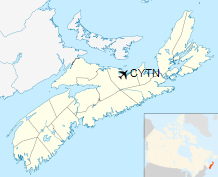
Location in Nova Scotia
|
| Runways |
| Direction |
Length |
Surface |
| ft |
m |
06/24 |
5,378 |
1,639 |
Asphalt |
|
|
Source: Canada Flight Supplement |
History
1929-1939
The airport began in 1929 as a private operation by a group of local pilots. In June 1932 the 320 ft
(98 m) grass strip was officially opened with the landing of a de Havilland Gypsy Moth by Canadian
aviation pioneer, Jimmy Wade. Later that year Jim Mollison, on his east to west crossing of the Atlantic
Ocean landed at the airport, which was later named after him.
1939-1945
Aerodrome
In approximately 1942 the aerodrome was listed as RCAF Aerodrome - New Glasgow & Trenton, Nova Scotia
at 45°37′N 062°37′W / 45.617°N 62.617°W with a variation of 24 degrees west and
elevation of 300 ft (91 m). The field was listed as "Turf field" and had two runways listed as follows:
| Runway Name |
Length |
Width |
Surface |
| 9/27 |
3,250 ft (990 m) |
300 ft (91 m) |
Turf |
| 14/32 |
3,950 ft (1,200 m) |
300 ft (91 m) |
Turf |
1945-present
In 1950, the airport left private ownership and became the property of the town of Trenton.
But in 2006, municipal officials felt "... the town of about 2,700 could no longer afford to maintain the
airport and its facilities, ..." After searching for a buyer the only bidder was Sobeys Capital Incorporated,
the airport's principal user.
Notable visitors to the airport include several prime ministers and other politicians as well as Babe Ruth, Bill Clinton, Queen Elizabeth and Prince Philip.
The above content comes from Wikipedia and is published under free licenses – click here to read more.
| General Info
|
| Country |
Canada
|
| ICAO ID |
CYTN
|
| Latitude |
45.611944
45° 36' 43.00" N
|
| Longitude |
-62.621111
062° 37' 16.00" W
|
| Elevation |
319 feet
97 meters
|
| Magnetic Variation |
019° W (01/06)
|
| Beacon |
Yes
|
| Operating Agency |
MILITARY - CIVIL JOINT USE AIRPORT
|
| Daylight Saving Time |
Second Sunday in March at 0200 to first Sunday in November at 0200 local time (Exception Arizona and that portion of Indiana in the Eastern Time Zone)
|
| Communications
|
CTAF/UNICOM
Opr 1200-2100Z++ Mon-Fri.
|
122.8
|
| MONCTON CNTR |
135.3
135.65
|
| Runways
|
ID
|
Dimensions |
Surface |
PCN |
ILS
|
| 07/25 |
5000 x 145 feet
1524 x 44 meters |
ASPHALT |
- |
NO
|
| 10/28 |
2200 x 60 feet
671 x 18 meters |
ASPHALT |
- |
NO
|
| Navaids
|
| Type |
ID |
Name |
Channel |
Freq |
Distance From Field |
Bearing From Navaid
|
| NDB |
5Y |
TRENTON |
- |
361 |
At Field |
-
|
| Supplies/Equipment
|
| Fuel |
Jet A1+, Jet A1 with icing inhibitor.
100/130 MIL Spec, low lead, aviation gasoline (BLUE)
|
The content above was published at Airports-Worldwide.com in 2019.
We don't guarantee the information is fresh and accurate. The data may
be wrong or outdated.
For more up-to-date information please refer to other sources.
|
|


