 |
|
Wabush Airport (IATA: YWK, ICAO: CYWK) is 1 nautical mile (1.9 km; 1.2 mi)
northeast of Wabush, Newfoundland and Labrador, Canada. It serves Labrador West as well as Fermont, Quebec.
|
Wabush Airport |
- IATA: YWK
- ICAO: CYWK
- WMO: 71825
|
| Summary |
| Airport type |
Public |
| Operator |
Transport Canada |
| Location |
Wabush, Newfoundland and Labrador |
| Time zone |
AST (UTC−04:00) |
| • Summer (DST) |
ADT (UTC−03:00) |
| Elevation AMSL |
1,809 ft / 551 m |
| Coordinates |
52°55′22″N
066°51′53″W |
| Website |
http://wabushairport.com/ |
| Map |
|
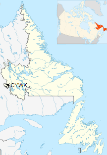
Location in Newfoundland and Labrador
|
| Runways |
| Direction |
Length |
Surface |
| ft |
m |
18/36 |
6,002 |
1,829 |
Asphalt |
|
| Statistics (2010) |
| Aircraft movements |
11,663 |
|
|
Sources: Canada Flight Supplement
Environment Canada
Movements from Statistics Canada |
Airlines and destinations
| Airlines |
Destinations |
| Air Canada Express |
Deer Lake, Gander, Goose Bay, Montréal–Trudeau, Quebec City, Sept-Îles, St. John's |
| Air Inuit |
Kuujjuaq, Schefferville, Sept-Îles |
| Air Liaison |
Baie-Comeau, Mont-Joli, Quebec City, Sept-Îles |
| PAL Airlines |
Charlo, Deer Lake (NL), Goose Bay, Mont-Joli, Montréal–Trudeau, Quebec City, Sept-Îles, St. Anthony, St. John's, Schefferville
Charter: Gander |
| Pascan Aviation |
Baie-Comeau, Mont-Joli, Montreal-Saint-Hubert, Quebec City, Sept-Îles |
The above content comes from Wikipedia and is published under free licenses – click here to read more.
| General Info
|
| Country |
Canada
|
| ICAO ID |
CYWK
|
| Latitude |
52.921944
52° 55' 19.00" N
|
| Longitude |
-66.864444
066° 51' 52.00" W
|
| Elevation |
1808 feet
551 meters
|
| Type |
Civil
|
| Magnetic Variation |
022° W (01/06)
|
| Beacon |
Yes
|
| Operating Agency |
CIVIL GOVERNMENT, (LANDING FEES AND DIPLOMATIC CLEARANCE MAY BE REQUIRED)
|
| Daylight Saving Time |
Second Sunday in March at 0200 to first Sunday in November at 0200 local time (Exception Arizona and that portion of Indiana in the Eastern Time Zone)
|
| Communications
|
| RDO |
122.0
296.2
|
| QUEBEC RDO |
126.7
|
| MF |
122.0
|
| MONTREAL CNTR |
132.25
|
| Communications Remarks |
|
| A/D |
(APP DEP svc)
|
| RDO |
Emerg only C709-282-6224.
|
| RCO |
(RCO)
|
| Runways
|
ID
|
Dimensions |
Surface |
PCN |
ILS
|
| 18/36 |
6000 x 150 feet
1829 x 46 meters |
ASPHALT |
047FBWT |
NO
|
| Navaids
|
| Type |
ID |
Name |
Channel |
Freq |
Distance From Field |
Bearing From Navaid
|
| VOR-DME |
YWK |
WABUSH |
070X |
112.3 |
2.3 NM |
212.8
|
| NDB |
WK |
WABUSH |
- |
218 |
3.8 NM |
006.4
|
| Supplies/Equipment
|
| Fuel |
Jet B, Wide cut turbine fuel, Without icing inhibitor.
100/130 MIL Spec, low lead, aviation gasoline (BLUE)
|
The content above was published at Airports-Worldwide.com in 2019.
We don't guarantee the information is fresh and accurate. The data may
be wrong or outdated.
For more up-to-date information please refer to other sources.
|
|


