 |
|
Mary's Harbour Airport (IATA: YMH, ICAO: CYMH) is 0.5 nautical miles (0.93 km; 0.58 mi) south of Mary's Harbour, Newfoundland and Labrador, Canada.
|
Mary's Harbour Airport |
- IATA: YMH
- ICAO: CYMH
- WMO: 71339
|
| Summary |
| Airport type |
Public |
| Operator |
Government of Newfoundland and Labrador |
| Location |
Mary's Harbour, Newfoundland and Labrador |
| Time zone |
NST (UTC−03:30) |
| • Summer (DST) |
NDT (UTC−02:30) |
| Elevation AMSL |
35 ft / 11 m |
| Coordinates |
52°18′10″N
055°50′52″W |
| Map |
|
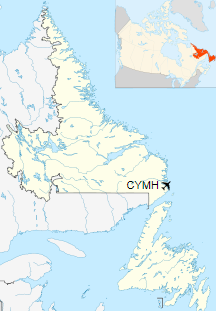
Location in Newfoundland and Labrador
|
| Runways |
| Direction |
Length |
Surface |
| ft |
m |
11/29 |
2,545 |
776 |
Gravel |
|
|
Sources: Canada Flight Supplement
Environment Canada |
Airlines and destinations
| Airlines |
Destinations |
| Air Borealis |
Black Tickle, Cartwright, Charlottetown (NL), Fox Harbour, Goose Bay, Port Hope Simpson, St. Anthony, Williams Harbour |
The above content comes from Wikipedia and is published under free licenses – click here to read more.
The content above was published at Airports-Worldwide.com in 2019.
We don't guarantee the information is fresh and accurate. The data may
be wrong or outdated.
For more up-to-date information please refer to other sources.
|
|


