 |
|
Saint-Léonard Aerodrome (IATA: YSL, ICAO: CYSL) is located 4 nautical miles (7.4 km; 4.6 mi) southeast
of Saint-Léonard, New Brunswick, Canada.
|
Saint-Léonard Aerodrome |
|
|
| Summary |
| Airport type |
Public |
| Owner |
J.D. Irving Ltd. |
| Location |
Saint-Léonard, New Brunswick |
| Time zone |
AST (UTC−04:00) |
| • Summer (DST) |
ADT (UTC−03:00) |
| Elevation AMSL |
794 ft / 242 m |
| Coordinates |
47°09′26″N
067°50′11″W |
| Map |
|
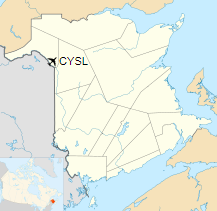
Location in New Brunswick
|
| Runways |
| Direction |
Length |
Surface |
| ft |
m |
18/36 |
4,021 |
1,226 |
Asphalt |
|
| Statistics (2006) |
|
|
|
Source: Canada Flight Supplement
Movements from Statistics Canada |
Recent history
The city of Edmundston purchased the airport for $1 and subsequently transferred the ownership to Madawaska Airport Authority.
In July 2015, Madawaska Airport Authority announced it would shut down some of the airport operations. J.D. Irving and
local community groups intervened to halted the closure of the airport. In October 2017, J.D. Irving purchased the airport
for $100,000.
Service
The airport had regularly scheduled flights to Montreal (Dorval) on Air Nova for part of the 1980s and 1990s.
The above content comes from Wikipedia and is published under free licenses – click here to read more.
| General Info
|
| Country |
Canada
|
| ICAO ID |
CYSL
|
| Time |
UTC-4(-3DT)
|
| Latitude |
47.157501
47° 09' 27.00" N
|
| Longitude |
-67.834722
067° 50' 05.00" W
|
| Elevation |
793 feet
242 meters
|
| Magnetic Variation |
018° W (01/06)
|
| Beacon |
Yes
|
| Operating Agency |
CIVIL GOVERNMENT, (LANDING FEES AND DIPLOMATIC CLEARANCE MAY BE REQUIRED)
|
| Operating Hours |
24 HOUR OPERATIONS
|
| International Clearance Status |
Airport of Entry
|
| Daylight Saving Time |
Second Sunday in March at 0200 to first Sunday in November at 0200 local time (Exception Arizona and that portion of Indiana in the Eastern Time Zone)
|
| Communications
|
CTAF/UNICOM
UNICOM opr ltd hr.
|
122.7
|
| QUEBEC RDO |
SEE REMARKS
|
| BOSTON CNTR |
124.75
239.05
|
| Communications Remarks |
|
| CNTR |
(APP/DEP svc)
|
| RDO |
(126.7 GCO. Key 4 times.)
|
| Runways
|
ID
|
Dimensions |
Surface |
PCN |
ILS
|
| 18/36 |
4000 x 100 feet
1219 x 30 meters |
ASPHALT |
076FBYT |
NO
|
| Navaids
|
| Type |
ID |
Name |
Channel |
Freq |
Distance From Field |
Bearing From Navaid
|
| NDB |
YSL |
ST LEONARD |
- |
404 |
3.3 NM |
174.5
|
| Supplies/Equipment
|
| Fuel |
Jet A1, without icing nhibitor.
100/130 MIL Spec, low lead, aviation gasoline (BLUE)
|
| Remarks
|
| FUEL |
(NC-100LL - Ltd hr, call out charge may be levied.)
|
| LGT |
ACTIVATE-MIRL, PAPI Rwy 18-36 and REIL Rwy 36-CTAF. PAPI Rwy 18-36, abbreviated unit for acft with eye-to-wheel hgt up to 10'.
|
| MISC |
Ltd win maint. Rwy 36 slopes down 0.45%.
|
The content above was published at Airports-Worldwide.com in 2019.
We don't guarantee the information is fresh and accurate. The data may
be wrong or outdated.
For more up-to-date information please refer to other sources.
|
|


