 |
|
Neepawa Airport, (TC LID: CJV5), is located 1.7 nautical miles (3.1 km; 2.0 mi) west of Neepawa, Manitoba, Canada.
The airport lies west of the town of Neepawa immediately north of the Yellowhead Highway. RCAF Station Neepawa was constructed during the Second World War under the British Commonwealth Air Training Plan(BCATP). It was one of many dozens of Canadian airports once used to train pilots and other air crew for the Royal Air Force and other British Commonwealth air forces. Tens of thousands of eager BCATP trainees from across the globe spent time in and around small towns throughout Canada, often experiencing severe winter weather for the first time. Their lives in Manitoba, on and off base, are romantically immortalized in the 1993 film For The Moment starring New Zealand actor Russell Crowe.
After the war until the 1960s, the original control tower was operated in support of civil aviation by the Canadian Department of Transport. Other airport facilities, including a hangar and a rifle range, continued for some years to serve Squadron 9 of the Royal Canadian Air Cadets and the local militia organization. Many of the original wooden buildings have since been demolished.
The airport is operated by the Town of Neepawa. It is used by owners of light and ultralight aircraft, chiefly for pleasure flying and crop dusting. The airport has also been employed for hanglider training. The property supports several light industrial enterprises.
| Neepawa Airport |
- IATA: none
- ICAO: none
- TC LID: CJV5
|
| Summary |
| Airport type |
Public |
| Operator |
Town of Neepawa |
| Location |
Langford RM, near Neepawa, Manitoba |
| Time zone |
CST (UTC-06:00) |
| Summer (DST) |
CDT (UTC-05:00) |
| Elevation AMSL |
1,277 ft / 389 m |
| Coordinates |
50°13′57″N
099°30′36″W |
| Map |
|
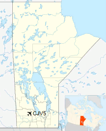
Location in Manitoba
|
| Runways |
| Direction |
Length |
Surface |
| ft |
m |
04/22 |
3,508 |
1,069 |
Asphalt |
|
|
Source: Canada Flight Supplement |
The above content comes from Wikipedia and is published under free licenses – click here to read more.
| General Info
|
| Country |
Canada
|
| Latitude |
50.232777
50° 13' 58.00" N
|
| Longitude |
-99.510556
099° 30' 38.00" W
|
| Elevation |
1277 feet
389 meters
|
| Magnetic Variation |
006° E (01/06)
|
| Beacon |
Yes
|
| Operating Agency |
MUNICIPAL
|
| Daylight Saving Time |
Second Sunday in March at 0200 to first Sunday in November at 0200 local time (Exception Arizona and that portion of Indiana in the Eastern Time Zone)
|
| Communications
|
| CTAF |
122.8
|
| Runways
|
ID
|
Dimensions |
Surface |
PCN |
ILS
|
| 04/22 |
3510 x 75 feet
1070 x 23 meters |
ASPHALT |
- |
NO
|
| Supplies/Equipment
|
| Fuel |
Jet A, without icing inhibitor.
100/130 MIL Spec, low lead, aviation gasoline (BLUE)
|
The content above was published at Airports-Worldwide.com in 2019.
We don't guarantee the information is fresh and accurate. The data may
be wrong or outdated.
For more up-to-date information please refer to other sources.
|
|


