 |
|
Altona Municipal Airport, (TC LID: CJL6), is located 1.5 nautical miles (2.8 km; 1.7 mi) southeast of Altona, Manitoba, Canada. The airport is about 100 km (62 mi) south-west of Winnipeg.
| Altona Municipal Airport |
- IATA: none
- ICAO: none
- TC LID: CJL6
|
| Summary |
| Airport type |
Public |
| Operator |
Altona Flying Club
Town of Altona
Rural Municipality of Rhineland |
| Location |
Rhineland R.M., near Altona, Manitoba |
| Time zone |
CST (UTC-06:00) |
| Summer (DST) |
CDT (UTC-05:00) |
| Elevation AMSL |
806 ft / 246 m |
| Coordinates |
49°05′40″N
097°32′02″W |
| Map |
|
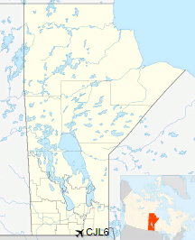
Location in Manitoba
|
| Runways |
| Direction |
Length |
Surface |
| ft |
m |
17/35 |
3,248 |
990 |
Asphalt |
08/26 |
2,000 |
610 |
Asphalt |
|
|
Source: Canada Flight Supplement |
The above content comes from Wikipedia and is published under free licenses – click here to read more.
| General Info
|
| Country |
Canada
|
| Latitude |
49.094444
49° 05' 40.00" N
|
| Longitude |
-97.533890
097° 32' 02.00" W
|
| Elevation |
806 feet
246 meters
|
| Magnetic Variation |
004° E (07/06)
|
| Beacon |
Yes
|
| Operating Agency |
PRIVATE
|
| Daylight Saving Time |
Second Sunday in March at 0200 to first Sunday in November at 0200 local time (Exception Arizona and that portion of Indiana in the Eastern Time Zone)
|
| Communications
|
| CTAF |
123.2
|
| Runways
|
ID
|
Dimensions |
Surface |
PCN |
ILS
|
| 08/26 |
2000 x 80 feet
610 x 24 meters |
GRASS OR EARTH NOT GRADED OR ROLLED. |
- |
NO
|
| 17/35 |
3248 x 75 feet
990 x 23 meters |
ASPHALT |
- |
NO
|
| Supplies/Equipment
|
| Fuel |
100/130 MIL Spec, low lead, aviation gasoline (BLUE)
|
The content above was published at Airports-Worldwide.com in 2019.
We don't guarantee the information is fresh and accurate. The data may be wrong or outdated.
For more up-to-date information please refer to other sources.
|
|


