 |
|
Vanderhoof Airport, (TC LID: CAU4), is located 1.3 nautical miles (2.4 km; 1.5 mi) north of Vanderhoof, British Columbia, Canada.
| Vanderhoof Airport |
- IATA: none
- ICAO: none
- TC LID: CAU4
|
| Summary |
| Airport type |
Public |
| Operator |
District of Vanderhoof |
| Location |
Vanderhoof, British Columbia |
| Time zone |
PST (UTC-08:00) |
| Summer (DST) |
PDT (UTC-07:00) |
| Elevation AMSL |
2,229 ft / 679 m |
| Coordinates |
54°02′48″N
124°00′40″W |
| Map |
|
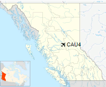
Location in British Columbia
|
| Runways |
| Direction |
Length |
Surface |
| ft |
m |
03/21 |
4,496 |
1,370 |
Turf/Gravel |
07/25 |
5,019 |
1,530 |
Asphalt |
15/33 |
3,331 |
1,015 |
Turf/Gravel |
|
|
Source: Canada Flight Supplement |
The above content comes from Wikipedia and is published under free licenses – click here to read more.
| General Info
|
| Country |
Canada
|
| Latitude |
54.046112
54° 02' 46.00" N
|
| Longitude |
-124.012500
124° 00' 45.00" W
|
| Elevation |
2225 feet
678 meters
|
| Magnetic Variation |
020° E (01/06)
|
| Operating Agency |
MUNICIPAL
|
| Daylight Saving Time |
Second Sunday in March at 0200 to first Sunday in November at 0200 local time (Exception Arizona and that portion of Indiana in the Eastern Time Zone)
|
| Communications
|
| CTAF |
122.8
|
| Runways
|
| ID |
Dimensions |
Surface |
PCN |
ILS
|
| 02/20 |
5200 x 180 feet
1585 x 55 meters |
GRAVEL. |
- |
NO
|
| 07/25 |
5018 x 100 feet
1529 x 30 meters |
ASPHALT |
010FDYT |
NO
|
| 15/33 |
3200 x 180 feet
975 x 55 meters |
GRAVEL. |
- |
NO
|
| Supplies/Equipment
|
| Fuel |
100/130 MIL Spec, low lead, aviation gasoline (BLUE)
|
The content above was published at Airports-Worldwide.com in 2019.
We don't guarantee the information is fresh and accurate. The data may
be wrong or outdated.
For more up-to-date information please refer to other sources.
|
|


