 |
|
Trail Airport (IATA: YZZ, TC LID: CAD4) is located 6.1 nautical miles (11.3 km; 7.0 mi) southeast of Trail, British Columbia, Canada and is situated in a valley beside the Columbia River. The airport serves both Trail and nearby Nelson and Castlegar.
The airport consists of one 4,001 ft x 75 ft (1,220 m x 23 m) asphalt runway and provides a GPS approach from the north (runway 16) and the south (runway 34).
Since April 10, 2006, Pacific Coastal has been flying into the airport using their Beechcraft 1900s, and occasionally their bigger Saab 340s.
In December 2017 Thanks to funding from the B.C. Air Access Program, the City of Trail offers a new 4,200 sq.ft. YZZ Airport Terminal Building (ATB) to accommodate the 22,000+ yearly travelers an even better travel experience with designated drop-off and pick-up zones, ample short-term and long-term parking, and a spacious waiting area with easy and convenient check in.
| Trail Regional Airport |
- IATA: YZZ
- ICAO: none
- TC LID: CAD4
|
| Summary |
| Airport type |
Public |
| Owner/Operator |
City of Trail |
| Serves |
West Kootenay |
| Location |
Trail, British Columbia |
| Time zone |
PST (UTC-08:00) |
| Summer (DST) |
PDT (UTC-07:00) |
| Elevation AMSL |
1,427 ft / 435 m |
| Coordinates |
49°03′20″N
117°36′33″W |
| Website |
http://www.trail.ca/en/regional-airport.asp |
| Map |
|
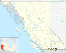
Location in British Columbia
|
| Runways |
| Direction |
Length |
Surface |
| ft |
m |
16/34 |
4,001 |
1,220 |
Asphalt |
|
|
Source: Canada Flight Supplement |
Airlines and destinations
| Airlines |
Destinations |
| Pacific Coastal Airlines |
Vancouver |
The above content comes from Wikipedia and is published under free licenses – click here to read more.
| General Info
|
| Country |
Canada
|
| Time |
UTC-8(-7DT)
|
| Latitude |
49.055556
49° 03' 20.00" N
|
| Longitude |
-117.609167
117° 36' 33.00" W
|
| Elevation |
1427 feet
435 meters
|
| Magnetic Variation |
017° E (01/06)
|
| Operating Agency |
CIVIL GOVERNMENT, (LANDING FEES AND DIPLOMATIC CLEARANCE MAY BE REQUIRED)
|
| International Clearance Status |
Airport of Entry
|
| Daylight Saving Time |
Second Sunday in March at 0200 to first Sunday in November at 0200 local time (Exception Arizona and that portion of Indiana in the Eastern Time Zone)
|
| Communications
|
| CTAF |
123.2
|
| Runways
|
| ID |
Dimensions |
Surface |
PCN |
ILS
|
| 16/34 |
4000 x 75 feet
1219 x 23 meters |
ASPHALT |
- |
NO
|
| Supplies/Equipment
|
| Fuel |
100/130 MIL Spec, low lead, aviation gasoline (BLUE)
|
| Remarks
|
| CAUTION |
Narrow valley.
|
| FUEL |
(NC-100LL)
|
| MISC |
Ltd win maint.
|
| TFC PAT |
Rwy 16 rgt tfc.
|
The content above was published at Airports-Worldwide.com in 2019.
We don't guarantee the information is fresh and accurate. The data may be wrong or outdated.
For more up-to-date information please refer to other sources.
|
|


