 |
|
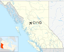
Smithers Airport, (IATA: YYD, ICAO: CYYD), is located 2 nautical miles (3.7 km; 2.3 mi) north of Smithers, British Columbia, Canada.
| Smithers Regional Airport |
- IATA: YYD
- ICAO: CYYD
- WMO: 71950
|
| Summary |
| Airport type |
Public |
| Operator |
Town of Smithers |
| Serves |
Smithers, Bulkley Valley |
| Location |
Smithers, British Columbia |
| Time zone |
PST (UTC-08:00) |
| Summer (DST) |
PDT (UTC-07:00) |
| Elevation AMSL |
1,716 ft / 523 m |
| Coordinates |
54°49′31″N
127°10′58″W |
| Map |
|
Location in British Columbia
|
| Runways |
| Direction |
Length |
Surface |
| ft |
m |
15/33 |
7,544 |
2,299 |
Asphalt |
|
| Statistics (2010) |
|
|
|
Sources: Canada Flight Supplement
Environment Canada
Movements from Statistics Canada |
Runways
Originally the runway was 5,000 ft (1,524 m), but it has been expanded to 7,544 ft (2,299 m) so that the airport can land larger aircraft. The extension was completed by in late 2008. Once the expansion of the ski areas is complete, there would then be a need for a runway capable of landing regional aircraft as large as the Boeing 737. Even though Smithers was previously served with older generation Boeing 737 aircraft in the 80s and early 90s, the newer variants of these aircraft require longer runways.
Landing runway 33 in 2007
NavCanada
NavCanada operates a Flight Service Station at Smithers Airport. Staffed hours of operations were cut on April 8, 2010 from 24 hours a day to 13 hours in the winter and 16 hours in the summer.
Manned hours of operation:
- June 1 - September 30, 1300-0500 UTC
- October 1 - May 31, 1500-0400 UTC (1400-0300 UTC Daylight Savings)
Airlines
| Airlines |
Destinations |
| Air Canada Express |
Vancouver |
| Central Mountain Air |
Prince George |
The above content comes from Wikipedia and is published under free licenses – click here to read more.
| General Info
|
| Country |
Canada
|
| ICAO ID |
CYYD
|
| Latitude |
54.824722
54° 49' 29.00" N
|
| Longitude |
-127.182778
127° 10' 58.00" W
|
| Elevation |
1712 feet
522 meters
|
| Type |
Civil
|
| Magnetic Variation |
021° E (01/06)
|
| Beacon |
Yes
|
| Operating Agency |
MUNICIPAL
|
| Daylight Saving Time |
Second Sunday in March at 0200 to first Sunday in November at 0200 local time (Exception Arizona and that portion of Indiana in the Eastern Time Zone)
|
| Communications
|
| PACIFIC RDO |
126.7
|
| RDO |
122.3
262.7
|
| MANDATORY FREQ RDO |
122.3
|
| Communications Remarks |
|
| RCO |
(KAMLOOPS FSS)
|
| FSS |
(Emerg only C250-847-2035)
|
| A/G |
Unusable blw 12000 ASL byd 5 NM btn 180 -270 and byd 20 NM btn 360 -070
|
| Runways
|
ID
|
Dimensions |
Surface |
PCN |
ILS
|
| 15/33 |
5000 x 150 feet
1524 x 46 meters |
ASPHALT |
070FCXT |
NO
|
| Navaids
|
| Type |
ID |
Name |
Channel |
Freq |
Distance From Field |
Bearing From Navaid
|
| NDB |
YD |
SMITHERS |
- |
230 |
5.3 NM |
307.4
|
| Supplies/Equipment
|
| Fuel |
Jet B, Wide cut turbine fuel, Without icing inhibitor.
100/130 MIL Spec, low lead, aviation gasoline (BLUE)
|
The content above was published at Airports-Worldwide.com in 2019.
We don't guarantee the information is fresh and accurate. The data may be wrong or outdated.
For more up-to-date information please refer to other sources.
|
|


