 |
|
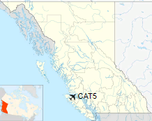
Port McNeill Airport, (IATA: YMP, TC LID: CAT5), is located 2 nautical miles (3.7 km; 2.3 mi) southeast of Port McNeill, British Columbia, Canada.
The nearest larger airport, Port Hardy Airport, is approximately 50 km (31 mi) west-northwest in Port Hardy.
| Port McNeill Airport |
- IATA: YMP
- ICAO: none
- TC LID: CAT5
|
| Summary |
| Airport type |
Public |
| Operator |
Town of Port McNeill |
| Location |
Port McNeill, British Columbia |
| Time zone |
PST (UTC-08:00) |
| Summer (DST) |
PDT (UTC-07:00) |
| Elevation AMSL |
225 ft / 69 m |
| Coordinates |
50°34′32″N
127°01′43″W |
| Map |
|
Location in British Columbia
|
| Runways |
| Direction |
Length |
Surface |
| ft |
m |
06/24 |
2,400 |
732 |
Asphalt |
11/29 |
3,650 |
1,113 |
Gravel |
|
|
Source: Canada Flight Supplement |
The above content comes from Wikipedia and is published under free licenses – click here to read more.
The content above was published at Airports-Worldwide.com in 2018.
We don't guarantee the information is fresh and accurate. The data may
be wrong or outdated.
For more up-to-date information please refer to other sources.
|
|


