 |
|
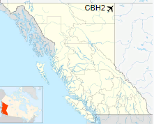
Helmet Airport, (TC LID: CBH2), is located 200 km (120 mi) north-east of Fort Nelson, in the Greater Sierra (oil field), British Columbia, Canada.
| Helmet Airport |
- IATA: none
- ICAO: none
- TC LID: CBH2
|
| Summary |
| Airport type |
Private |
| Operator |
Canadian Natural Resources Ltd. |
| Location |
Greater Sierra (oil field) |
| Time zone |
PST (UTC-08:00) |
| Summer (DST) |
PDT (UTC-07:00) |
| Elevation AMSL |
1,930 ft / 588 m |
| Coordinates |
59°25′33″N
120°47′51″W |
| Map |
|
Location in British Columbia
|
| Runways |
| Direction |
Length |
Surface |
| ft |
m |
12/30 |
4,521 |
1,378 |
Gravel |
|
|
Source: Canada Flight Supplement |
The above content comes from Wikipedia and is published under free licenses – click here to read more.
The content above was published at Airports-Worldwide.com in 2018.
We don't guarantee the information is fresh and accurate. The data may
be wrong or outdated.
For more up-to-date information please refer to other sources.
|
|


