 |
|
Northern Rockies Regional Airport (Fort Nelson Airport), (IATA: YYE, ICAO: CYYE), is located 3.8 nautical miles (7.0 km; 4.4 mi) east northeast of Fort Nelson, British Columbia, Canada.
Northern Rockies Regional Airport
Fort Nelson Airport |
- IATA: YYE
- ICAO: CYYE
- WMO: 71945
|
| Summary |
| Airport type |
Public |
| Operator |
Northern Rockies Regional Municipality |
| Location |
Fort Nelson, British Columbia |
| Time zone |
MST (UTC-07:00) |
| Elevation AMSL |
1,253 ft / 382 m |
| Coordinates |
58°50′11″N
122°35′49″W |
| Website |
http://www.flynorthernrockies.ca/ |
| Map |
|
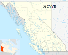
Location in British Columbia
|
| Runways |
| Direction |
Length |
Surface |
| ft |
m |
04/22 |
6,402 |
1,951 |
Asphalt |
08/26 |
3,587 |
1,093 |
Asphalt |
|
| Statistics (2010) |
| Aircraft movements |
21,371 |
|
|
Sources: Canada Flight Supplement
Environment Canada
Movements from Statistics Canada |
Airlines and destinations
| Airlines |
Destinations |
| Central Mountain Air |
Prince George |
| Flair Airlines |
Charter: Kelowna, Vancouver, Victoria, Comox |
Historical airline service
Commencing during the early 1940s, scheduled passenger service was operated in the past by Canadian Pacific Air Lines and its successors CP Air and Canadian Airlines International to Vancouver, British Columbia; Edmonton, Alberta; Prince George, British Columbia; Fort St. John, British Columbia and Watson Lake, Yukon. CP Air served the airport with Boeing 737-200 jetliners during the 1970s with direct, no change of plane flights to all of the above destinations.
Other Canadian Pacific flights into the airport over the years were operated with such twin engine prop aircraft as the Lockheed Lodestar, the Douglas DC-3 and the Convair 240 as well as with the larger, four engine Douglas DC-6B propliner and the Bristol Britannia turboprop.
The above content comes from Wikipedia and is published under free licenses – click here to read more.
| General Info
|
| Country |
Canada
|
| ICAO ID |
CYYE
|
| Latitude |
58.836389
58° 50' 11.00" N
|
| Longitude |
-122.596944
122° 35' 49.00" W
|
| Elevation |
1253 feet
382 meters
|
| Type |
Civil
|
| Magnetic Variation |
022° E (01/06)
|
| Beacon |
Yes
|
| Operating Agency |
MUNICIPAL
|
| Daylight Saving Time |
Second Sunday in March at 0200 to first Sunday in November at 0200 local time (Exception Arizona and that portion of Indiana in the Eastern Time Zone)
|
| Communications
|
| EDMONTON RDO |
126.7
|
| VDF |
121.9
122.2
|
| RDO |
122.2
295.0
|
| EDMONTON CNTR |
132.87
134.85
290.6
|
| MF NELSON RDO |
122.2
|
| Communications Remarks |
|
| FSS |
(Emerg only C250-774-3124)
|
| A/G |
MANDATORY FREQUENCY 5NM TO 4300 MSL
|
| Runways
|
ID
|
Dimensions |
Surface |
PCN |
ILS
|
| 03/21 |
6400 x 200 feet
1951 x 61 meters |
ASPHALT |
061FBWT |
NO
|
| 07/25 |
4068 x 77 feet
1240 x 23 meters |
ASPHALT |
016FCWT |
NO
|
| Navaids
|
| Type |
ID |
Name |
Channel |
Freq |
Distance From Field |
Bearing From Navaid
|
| VOR-DME |
YYE |
FORT NELSON |
076X |
112.9 |
9.9 NM |
080.1
|
| NDB |
YE |
FORT NELSON |
- |
382 |
4.6 NM |
034.1
|
| Supplies/Equipment
|
| Fuel |
Jet A1+, Jet A1 with icing inhibitor.
Jet B, Wide cut turbine fuel, Without icing inhibitor.
100/130 octane gasoline, leaded, MIL-L-5572F (GREEN)
100/130 MIL Spec, low lead, aviation gasoline (BLUE)
|
The content above was published at Airports-Worldwide.com in 2018.
We don't guarantee the information is fresh and accurate. The data may
be wrong or outdated.
For more up-to-date information please refer to other sources.
|
|


