|
Denny Island Aerodrome, previously Bella Bella (Denny Island) Airport, (ICAO: CYJQ), is located 2 nautical miles (3.7 km; 2.3 mi) east of Bella Bella, British Columbia, on Denny Island.
This airport has no services or fuel, however the fuel dock at nearby Shearwater is accessible to floatplanes and helicopters. The runway is limited to Day/VFR operations only.
| Denny Island Aerodrome |
|
|
| Summary |
| Airport type |
Public |
| Operator |
Denny Island Airport Commission c/o Central Coast Regional District |
| Location |
Denny Island, British Columbia |
| Time zone |
PST (UTC-08:00) |
| Summer (DST) |
PDT (UTC-07:00) |
| Elevation AMSL |
162 ft / 49 m |
| Coordinates |
52°08′23″N
128°03′49″W |
| Map |
|
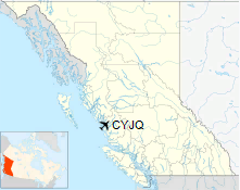
Location in British Columbia
|
| Runways |
| Direction |
Length |
Surface |
| ft |
m |
10/28 |
2,954 |
900 |
Asphalt |
|
|
Source: Canada Flight Supplement |
The above content comes from Wikipedia and is published under free licenses – click here to read more.
The content above was published at Airports-Worldwide.com in 2018.
We don't guarantee the information is fresh and accurate. The data may
be wrong or outdated.
For more up-to-date information please refer to other sources.
|


