 |
|
Dease Lake Airport, (IATA: YDL, ICAO: CYDL), is located 1.5 nautical miles (2.8 km; 1.7 mi) south of Dease Lake, British Columbia, Canada.
| Dease Lake Airport |
|
|
| Summary |
| Airport type |
Public |
| Operator |
Stikine Airport Society |
| Location |
Dease Lake, British Columbia |
| Time zone |
PST (UTC-08:00) |
| Summer (DST) |
PDT (UTC-07:00) |
| Elevation AMSL |
2,634 ft / 803 m |
| Coordinates |
58°25′20″N
130°01′53″W |
| Map |
|
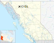
Location in British Columbia
|
| Runways |
| Direction |
Length |
Surface |
| ft |
m |
02/20 |
6,003 |
1,830 |
Asphalt |
|
|
Source: Canada Flight Supplement |
Airlines
| Airlines |
Destinations |
| Central Mountain Air |
Charter: Smithers, Prince George |
The above content comes from Wikipedia and is published under free licenses – click here to read more.
| General Info
|
| Country |
Canada
|
| ICAO ID |
CYDL
|
| Latitude |
58.422222
58° 25' 20.00" N
|
| Longitude |
-130.032222
130° 01' 56.00" W
|
| Elevation |
2600 feet
792 meters
|
| Magnetic Variation |
023° E (01/06)
|
| Operating Agency |
MUNICIPAL
|
| Daylight Saving Time |
Second Sunday in March at 0200 to first Sunday in November at 0200 local time (Exception Arizona and that portion of Indiana in the Eastern Time Zone)
|
| Communications
|
| WHITEHORSE RDO |
126.7
|
| CTAF |
123.2
|
| EDMONTON CNTR |
134.05
|
| Runways
|
| ID |
Dimensions |
Surface |
PCN |
ILS
|
| 02/20 |
6000 x 90 feet
1829 x 27 meters |
ASPHALT |
- |
NO
|
| Navaids
|
| Type |
ID |
Name |
Channel |
Freq |
Distance From Field |
Bearing From Navaid
|
| NDB |
YDL |
DEASE LAKE |
- |
200 |
2.2 NM |
185.1
|
| Supplies/Equipment
|
| Fuel |
Jet B, Wide cut turbine fuel, Without icing inhibitor.
100/130 MIL Spec, low lead, aviation gasoline (BLUE)
|
The content above was published at Airports-Worldwide.com in 2018.
We don't guarantee the information is fresh and accurate. The data may
be wrong or outdated.
For more up-to-date information please refer to other sources.
|
|


