 |
|
Cache Creek Airport (IATA: YZA, TC LID: CAZ5), aka Ashcroft Regional Airport is located near to Cache Creek, British Columbia, Canada.
| Cache Creek Airport |
- IATA: YZA
- ICAO: none
- TC LID: CAZ5
|
| Summary |
| Airport type |
Public |
| Operator |
Village of Cache Creek |
| Location |
Cache Creek, British Columbia |
| Time zone |
PST (UTC-08:00) |
| Summer (DST) |
PDT (UTC-07:00) |
| Elevation AMSL |
2,040 ft / 622 m |
| Coordinates |
50°46′30″N
121°19′18″W |
| Map |
|
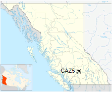
Location in British Columbia
|
| Runways |
| Direction |
Length |
Surface |
| ft |
m |
15/33 |
3,275 |
998 |
Asphalt |
|
|
Source: Canada Flight Supplement |
The above content comes from Wikipedia and is published under free licenses – click here to read more.
The content above was published at Airports-Worldwide.com in 2018.
We don't guarantee the information is fresh and accurate. The data may
be wrong or outdated.
For more up-to-date information please refer to other sources.
|
|


