 |
|
Bella Coola Airport, (IATA: QBC, ICAO: CYBD), is located 6 nautical miles (11 km; 6.9 mi) northeast of Bella Coola, British Columbia, Canada.
This airport is limited to Day/VFR operations. Weather reports are available most days until 3PM local time by contacting Kamloops Flight Service (Nav Canada).
| Bella Coola Airport |
- IATA: QBC
- ICAO: CYBD
- WMO: 71206
|
| Summary |
| Airport type |
Private |
| Operator |
Central Coast Regional District |
| Location |
Bella Coola, British Columbia |
| Time zone |
PST (UTC-08:00) |
| Summer (DST) |
PDT (UTC-07:00) |
| Elevation AMSL |
117 ft / 36 m |
| Coordinates |
52°23′15″N
126°35′45″W |
| Map |
|
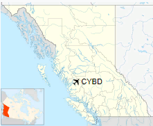
Location in British Columbia
|
| Runways |
| Direction |
Length |
Surface |
| ft |
m |
05/23 |
4,200 |
1,280 |
Asphalt |
|
Source: Canada Flight Supplement
Environment Canada |
Airlines and destinations
| Airlines |
Destinations |
| Pacific Coastal Airlines |
Anahim Lake, Vancouver |
The above content comes from Wikipedia and is published under free licenses – click here to read more.
| General Info
|
| Country |
Canada
|
| ICAO ID |
CYBD
|
| Latitude |
52.387501
52° 23' 15.00" N
|
| Longitude |
-126.595833
126° 35' 45.00" W
|
| Elevation |
117 feet
36 meters
|
| Magnetic Variation |
020° E (01/06)
|
| Operating Agency |
MUNICIPAL
|
| Daylight Saving Time |
Second Sunday in March at 0200 to first Sunday in November at 0200 local time (Exception Arizona and that portion of Indiana in the Eastern Time Zone)
|
| Communications
|
| PACIFIC RDO |
126.7
|
| CTAF |
122.8
|
| Communications Remarks |
|
| RCO |
(KAMLOOPS FSS)
|
| Runways
|
ID
|
Dimensions |
Surface |
PCN |
ILS
|
| 05/23 |
4200 x 100 feet
1280 x 30 meters |
ASPHALT |
- |
NO
|
The content above was published at Airports-Worldwide.com in 2018.
We don't guarantee the information is fresh and accurate. The data may
be wrong or outdated.
For more up-to-date information please refer to other sources.
|
|


