 |
|
Three Hills Airport, (TC LID: CEN3), is located 2 nautical miles (3.7 km; 2.3 mi) east southeast of Three Hills, Alberta, Canada.
The Prairie School of Mission Aviation (PSMA), an affiliate of Prairie Bible College, utilizes this airport as its training base. PSMA offers a 2-year Associate of Arts in Mission Aviation degree to successful graduates of the program.
| Three Hills Airport |
- IATA: none
- ICAO: none
- TC LID: CEN3
|
| Summary |
| Airport type |
Public |
| Operator |
Town of Three Hills |
| Location |
Kneehill County, near Three Hills, Alberta |
| Time zone |
MST (UTC−07:00) |
| Summer (DST) |
MDT (UTC−06:00) |
| Elevation AMSL |
2,975 ft / 907 m |
| Coordinates |
51°41′48″N
113°12′33″W |
| Map |
|
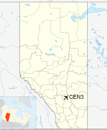
Location in Alberta
|
| Runways |
| Direction |
Length |
Surface |
| ft |
m |
11/29 |
3,000 |
914 |
Asphalt |
|
The above content comes from Wikipedia and is published under free licenses – click here to read more.
| General Info
|
| Country |
Canada
|
| Latitude |
51.696667
51° 41' 48.00" N
|
| Longitude |
-113.209167
113° 12' 33.00" W
|
| Elevation |
2975 feet
907 meters
|
| Magnetic Variation |
016° E (01/06)
|
| Beacon |
Yes
|
| Operating Agency |
MUNICIPAL
|
| Daylight Saving Time |
Second Sunday in March at 0200 to first Sunday in November at 0200 local time (Exception Arizona and that portion of Indiana in the Eastern Time Zone)
|
| Communications
|
| CTAF |
123.2
|
| Runways
|
ID
|
Dimensions |
Surface |
PCN |
ILS
|
| 11/29 |
3000 x 75 feet
914 x 23 meters |
ASPHALT |
- |
NO
|
| Navaids
|
| Type |
ID |
Name |
Channel |
Freq |
Distance From Field |
Bearing From Navaid
|
| NDB |
Z1 |
THREE HILLS |
- |
305 |
At Field |
-
|
| Supplies/Equipment
|
| Fuel |
100/130 MIL Spec, low lead, aviation gasoline (BLUE)
|
The content above was published at Airports-Worldwide.com in 2018.
We don't guarantee the information is fresh and accurate. The data may
be wrong or outdated.
For more up-to-date information please refer to other sources.
|
|


