 |
|
Pelican Airport, (TC LID: CFT8), is located 31 km (19 mi) east of Wabasca, Alberta, Canada.
It is a private aerodrome that serves the Wabasca oil field.
| Pelican Airport |
- IATA: none
- ICAO: none
- TC LID: CFT8
|
| Summary |
| Airport type |
Private |
| Operator |
Canadian Natural Resources Ltd |
| Location |
Wabasca oil field, Municipal District of Opportunity No. 17, Alberta |
| Time zone |
MST (UTC−07:00) |
| Summer (DST) |
MDT (UTC−06:00) |
| Elevation AMSL |
2,059 ft / 628 m |
| Coordinates |
56°09′39″N
113°28′25″W |
| Map |
|
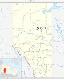
Location in Alberta
|
| Runways |
| Direction |
Length |
Surface |
| ft |
m |
07/25 |
3,872 |
1,180 |
Asphalt |
|
The above content comes from Wikipedia and is published under free licenses – click here to read more.
| General Info
|
| Country |
Canada
|
| Latitude |
56.160833
56° 09' 39.00" N
|
| Longitude |
-113.473611
113° 28' 25.00" W
|
| Elevation |
2059 feet
628 meters
|
| Magnetic Variation |
017° E (01/06)
|
| Operating Agency |
PRIVATE
|
| Daylight Saving Time |
Second Sunday in March at 0200 to first Sunday in November at 0200 local time (Exception Arizona and that portion of Indiana in the Eastern Time Zone)
|
| Communications
|
| CTAF/UNICOM |
122.8
|
| Runways
|
ID
|
Dimensions |
Surface |
PCN |
ILS
|
| 07/25 |
3872 x 75 feet
1180 x 23 meters |
ASPHALT |
- |
NO
|
The content above was published at Airports-Worldwide.com in 2018.
We don't guarantee the information is fresh and accurate. The data may
be wrong or outdated.
For more up-to-date information please refer to other sources.
|
|


