 |
|
Manning Airport, (TC LID: CFX4), is located 1.8 nautical miles (3.3 km; 2.1 mi) northwest of Manning, Alberta, Canada.
| Manning Airport |
- IATA: none
- ICAO: none
- TC LID: CFX4
|
| Summary |
| Airport type |
Public |
| Operator |
County of Northern Lights |
| Location |
County of Northern Lights, near Manning, Alberta |
| Time zone |
MST (UTC−07:00) |
| Summer (DST) |
MDT (UTC−06:00) |
| Elevation AMSL |
1,612 ft / 491 m |
| Coordinates |
56°57′03″N
117°38′39″W |
| Map |
|
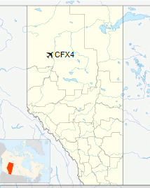
Location in Alberta
|
| Runways |
| Direction |
Length |
Surface |
| ft |
m |
07/25 |
5,580 |
1,701 |
Asphalt |
|
The above content comes from Wikipedia and is published under free licenses – click here to read more.
| General Info
|
| Country |
Canada
|
| Latitude |
56.950832
56° 57' 03.00" N
|
| Longitude |
-117.644167
117° 38' 39.00" W
|
| Elevation |
1612 feet
491 meters
|
| Magnetic Variation |
020° E (01/06)
|
| Beacon |
Yes
|
| Operating Agency |
MUNICIPAL
|
| Daylight Saving Time |
Second Sunday in March at 0200 to first Sunday in November at 0200 local time (Exception Arizona and that portion of Indiana in the Eastern Time Zone)
|
| Communications
|
| CTAF |
123.2
|
| Runways
|
ID
|
Dimensions |
Surface |
PCN |
ILS
|
| 07/25 |
5577 x 100 feet
1700 x 30 meters |
ASPHALT |
- |
NO
|
| Navaids
|
| Type |
ID |
Name |
Channel |
Freq |
Distance From Field |
Bearing From Navaid
|
| NDB-DME |
M5 |
MANNING |
049X |
307 |
At Field |
-
|
| Supplies/Equipment
|
| Fuel |
Jet B, Wide cut turbine fuel, Without icing inhibitor.
100/130 octane gasoline, leaded, MIL-L-5572F (GREEN)
|
The content above was published at Airports-Worldwide.com in 2018.
We don't guarantee the information is fresh and accurate. The data may
be wrong or outdated.
For more up-to-date information please refer to other sources.
|
|


