 |
|
Lacombe Regional Airport, (TC LID: CEG3), is located in the northeast corner of the City of Lacombe, Alberta, Canada. It is the only airport in the surrounding Lacombe County.
| Lacombe Regional Airport |
- IATA: none
- ICAO: none
- TC LID: CEG3
|
| Summary |
| Airport type |
Public |
| Owner |
City of Lacombe |
| Operator |
Lacombe Flying Club |
| Serves |
Lacombe and area |
| Location |
Lacombe, Alberta |
| Time zone |
MST (UTC−07:00) |
| Summer (DST) |
MDT (UTC−06:00) |
| Elevation AMSL |
2,783 ft / 848 m |
| Coordinates |
52°29′18″N
113°42′44″W |
| Map |
|
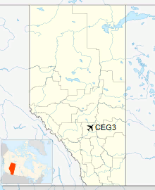
Location in Alberta
|
| Runways |
| Direction |
Length |
Surface |
| ft |
m |
16/34 |
3,000 |
914 |
Asphalt |
|
The above content comes from Wikipedia and is published under free licenses – click here to read more.
| General Info
|
| Country |
Canada
|
| Latitude |
52.488333
52° 29' 18.00" N
|
| Longitude |
-113.712222
113° 42' 44.00" W
|
| Elevation |
2783 feet
848 meters
|
| Magnetic Variation |
016° E (01/06)
|
| Beacon |
Yes
|
| Operating Agency |
PRIVATE
|
| Daylight Saving Time |
Second Sunday in March at 0200 to first Sunday in November at 0200 local time (Exception Arizona and that portion of Indiana in the Eastern Time Zone)
|
| Communications
|
| CTAF/UNICOM |
122.8
|
| Runways
|
ID
|
Dimensions |
Surface |
PCN |
ILS
|
| 16/34 |
3000 x 74 feet
914 x 23 meters |
ASPHALT |
- |
NO
|
| Supplies/Equipment
|
| Fuel |
100/130 octane gasoline, leaded, MIL-L-5572F (GREEN)
80/87 octane gasoline, leaded, MIL-L-5572F (RED)
|
The content above was published at Airports-Worldwide.com in 2018.
We don't guarantee the information is fresh and accurate. The data may
be wrong or outdated.
For more up-to-date information please refer to other sources.
|
|


