 |
|
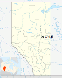
Lac La Biche Airport, (IATA: YLB, ICAO: CYLB), is located 1.5 nautical miles (2.8 km; 1.7 mi) west of Lac La Biche, Alberta, Canada.
| Lac La Biche Airport |
|
|
| Summary |
| Airport type |
Public |
| Operator |
County of Lac La Biche |
| Location |
Lac La Biche County, near Lac La Biche, Alberta |
| Time zone |
MST (UTC−07:00) |
| Summer (DST) |
MDT (UTC−06:00) |
| Elevation AMSL |
1,884 ft / 574 m |
| Coordinates |
54°46′13″N
112°01′54″W |
| Map |
|
Location in Alberta
|
| Runways |
| Direction |
Length |
Surface |
| ft |
m |
11/29 |
5,704 |
1,739 |
Asphalt |
|
The above content comes from Wikipedia and is published under free licenses – click here to read more.
| General Info
|
| Country |
Canada
|
| ICAO ID |
CYLB
|
| Latitude |
54.770279
54° 46' 13.00" N
|
| Longitude |
-112.031667
112° 01' 54.00" W
|
| Elevation |
1884 feet
574 meters
|
| Magnetic Variation |
016° E (01/06)
|
| Beacon |
Yes
|
| Operating Agency |
MUNICIPAL
|
| Alternate Name |
PLAMONDON
|
| Daylight Saving Time |
Second Sunday in March at 0200 to first Sunday in November at 0200 local time (Exception Arizona and that portion of Indiana in the Eastern Time Zone)
|
| Communications
|
| EDMONTON RDO |
126.7
|
| CTAF |
123.2
|
| EDMONTON CNTR |
134.7
250.05
|
| Runways
|
ID
|
Dimensions |
Surface |
PCN |
ILS
|
| 11/29 |
5700 x 100 feet
1737 x 30 meters |
ASPHALT |
- |
NO
|
| Navaids
|
| Type |
ID |
Name |
Channel |
Freq |
Distance From Field |
Bearing From Navaid
|
| NDB |
YLB |
LAC LA BICHE |
- |
272 |
1.3 NM |
291.0
|
The content above was published at Airports-Worldwide.com in 2018.
We don't guarantee the information is fresh and accurate. The data may
be wrong or outdated.
For more up-to-date information please refer to other sources.
|
|


