 |
|
High River Regional Airport, (TC LID: CEN4), is a registered aerodrome located 2.5 nautical miles (4.6 km; 2.9 mi) south southeast of High River, Alberta, Canada.
| High River Regional Airport |
- IATA: none
- ICAO: none
- TC LID: CEN4
|
| Summary |
| Airport type |
Public |
| Operator |
High River Regional Airport Ltd. |
| Location |
Foothills No. 31, near High River, Alberta |
| Time zone |
MST (UTC-07:00) |
| Summer (DST) |
MDT (UTC-06:00) |
| Elevation AMSL |
3,431 ft / 1,046 m |
| Coordinates |
50°32′N
113°50′W |
| Website |
www.highriverairport.ca |
| Map |
|
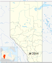
Location in Alberta
|
| Runways |
| Direction |
Length |
Surface |
| ft |
m |
07/25 |
4,150 |
1,265 |
Asphalt |
|
The above content comes from Wikipedia and is published under free licenses – click here to read more.
| General Info
|
| Country |
Canada
|
| Latitude |
50.533333
50° 32' 00.00" N
|
| Longitude |
-113.833333
113° 50' 00.00" W
|
| Elevation |
3431 feet
1046 meters
|
| Type |
Civil
|
| Magnetic Variation |
016° E (01/06)
|
| Beacon |
Yes
|
| Operating Agency |
MUNICIPAL
|
| Daylight Saving Time |
Second Sunday in March at 0200 to first Sunday in November at 0200 local time (Exception Arizona and that portion of Indiana in the Eastern Time Zone)
|
| Communications
|
| CTAF |
123.0
|
| Runways
|
ID
|
Dimensions |
Surface |
PCN |
ILS
|
| 06/24 |
3000 x 75 feet
914 x 23 meters |
ASPHALT |
- |
NO
|
14/32
CLOSED |
2950 x 75 feet
899 x 23 meters |
GRAVEL. |
- |
NO
|
| Supplies/Equipment
|
| Fuel |
100/130 MIL Spec, low lead, aviation gasoline (BLUE)
|
The content above was published at Airports-Worldwide.com in 2018.
We don't guarantee the information is fresh and accurate. The data may
be wrong or outdated.
For more up-to-date information please refer to other sources.
|
|


