|
|
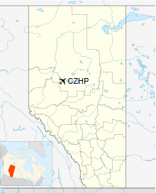
High Prairie Airport, (IATA: ZHP, ICAO: CZHP), is located 2 nautical miles (3.7 km; 2.3 mi) south of High Prairie, Alberta, Canada.
| High Prairie Airport |
|
|
| Summary |
| Airport type |
Public |
| Operator |
Big Lakes County |
| Location |
Big Lakes County, near High Prairie, Alberta |
| Time zone |
MST (UTC-07:00) |
| Summer (DST) |
MDT (UTC-06:00) |
| Elevation AMSL |
1,978 ft / 603 m |
| Coordinates |
55°23'37″N 116°28'33″W |
| Map |
|
|
| Runways |
| Direction |
Length |
Surface |
| ft |
m |
| 07/25 |
3,934 |
1,199 |
Asphalt |
|
| Helipads |
| Number |
Length |
Surface |
| ft |
m |
| 1 |
50 x 50 |
15 x 15 |
Turf |
|
The above content comes from Wikipedia and is published under free licenses – click here to read more.
| General
Info
|
| Country |
Canada
|
| ICAO
ID |
CZHP
|
| Latitude |
55.393612
55° 23' 37.00" N
|
| Longitude |
-116.475278
116° 28' 31.00" W
|
| Elevation |
1974
feet
602 meters
|
| Magnetic
Variation |
019°
E (01/06)
|
| Beacon |
Yes
|
| Operating
Agency |
MUNICIPAL
|
| Daylight
Saving Time |
Second
Sunday in March at 0200 to first Sunday in November at 0200 local
time (Exception Arizona and that portion of Indiana in the Eastern
Time Zone) |
| Communications
|
| CTAF |
122.8
|
| Runways
|
| ID |
Dimensions |
Surface |
PCN |
ILS
|
| 07/25
|
3933
x 75 feet
1199 x 23 meters |
ASPHALT |
- |
NO
|
| Navaids
|
| Type |
ID |
Name |
Channel |
Freq |
Distance
From Field |
Bearing
From Navaid
|
| NDB-DME |
2S |
HIGH
PRAIRIE |
039X |
406 |
At
Field |
-
|
| Supplies/Equipment
|
| Fuel |
100/130
octane gasoline, leaded, MIL-L-5572F (GREEN)
80/87 octane gasoline, leaded, MIL-L-5572F (RED) |
The content above was published at Airports-Worldwide.com in 2018.
We don't guarantee the information is fresh and accurate. The data may be wrong or outdated.
For more up-to-date information please refer to other sources.
|
|