 |
|
De Winton/South Calgary Airport |
De Winton/South Calgary Airport, (TC LID: CEH4), is located 7 nautical miles (13 km; 8.1 mi) east of De Winton, Alberta, Canada.
During World War II the aerodrome was known as RCAF Station De Winton, and hosted a Royal Air Force (RAF) elementary flying training school which eventually became part of the British Commonwealth Air Training Plan.
| De Winton/South Calgary Airport |
- IATA: none
- ICAO: none
- TC LID: CEH4
|
| Summary |
| Airport type |
Private |
| Operator |
Cordillera Petroleum of Canada Ltd. |
| Location |
Foothills No. 31, near De Winton, Alberta |
| Time zone |
MST (UTC-07:00) |
| Summer (DST) |
MDT (UTC-06:00) |
| Elevation AMSL |
3,355 ft / 1,023 m |
| Coordinates |
50°49′19″N
113°49′28″W |
| Map |
|
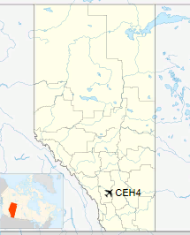
Location in Alberta
|
| Runways |
| Direction |
Length |
Surface |
| ft |
m |
10/28 |
3,015 |
919 |
Asphalt |
16/34 |
2,931 |
893 |
Asphalt |
|
The above content comes from Wikipedia and is published under free licenses – click here to read more.
| General Info
|
| Country |
Canada
|
| Latitude |
50.821945
50° 49' 19.00" N
|
| Longitude |
-113.824444
113° 49' 28.00" W
|
| Elevation |
3355 feet
1023 meters
|
| Magnetic Variation |
016° E (01/06)
|
| Operating Agency |
PRIVATE
|
| Alternate Name |
SOUTH CALGARY
|
| Daylight Saving Time |
Second Sunday in March at 0200 to first Sunday in November at 0200 local time (Exception Arizona and that portion of Indiana in the Eastern Time Zone)
|
| Communications
|
| CTAF |
122.8
|
| Runways
|
| ID |
Dimensions |
Surface |
PCN |
ILS
|
| 10/28 |
3015 x 150 feet
919 x 46 meters |
ASPHALT |
- |
NO
|
| 16/34 |
2931 x 150 feet
893 x 46 meters |
ASPHALT |
- |
NO
|
The content above was published at Airports-Worldwide.com in 2019.
We don't guarantee the information is fresh and accurate. The data may
be wrong or outdated.
For more up-to-date information please refer to other sources.
|
|


