 |
|
Castor Airport, (TC LID: CER2), is located 1 nautical mile (1.9 km; 1.2 mi) west of Castor, Alberta, Canada.
| Castor Airport |
- IATA: none
- ICAO: none
- TC LID: CER2
|
| Summary |
| Airport type |
Public |
| Operator |
Town of Castor |
| Location |
County of Paintearth No. 18, near Castor, Alberta |
| Time zone |
MST (UTC-07:00) |
| Summer (DST) |
MDT (UTC-06:00) |
| Elevation AMSL |
2,704 ft / 824 m |
| Coordinates |
52°13′N
111°56′W |
| Map |
|
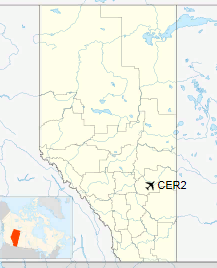
Location in Alberta
|
| Runways |
| Direction |
Length |
Surface |
| ft |
m |
13/31 |
3,000 |
914 |
Asphalt |
|
The above content comes from Wikipedia and is published under free licenses – click here to read more.
| General Info
|
| Country |
Canada
|
| Latitude |
52.216667
52° 13' 00.00" N
|
| Longitude |
-111.933330
111° 55' 59.99" W
|
| Elevation |
2704 feet
824 meters
|
| Magnetic Variation |
015° E (01/06)
|
| Beacon |
Yes
|
| Operating Agency |
MUNICIPAL
|
| Daylight Saving Time |
Second Sunday in March at 0200 to first Sunday in November at 0200 local time (Exception Arizona and that portion of Indiana in the Eastern Time Zone)
|
| Communications
|
| CTAF |
123.2
|
| Runways
|
| ID |
Dimensions |
Surface |
PCN |
ILS
|
| 13/31 |
3000 x 75 feet
914 x 23 meters |
ASPHALT |
- |
NO
|
| Supplies/Equipment
|
| Fuel |
100/130 octane gasoline, leaded, MIL-L-5572F (GREEN)
80/87 octane gasoline, leaded, MIL-L-5572F (RED)
|
The content above was published at Airports-Worldwide.com in 2019.
We don't guarantee the information is fresh and accurate. The data may be wrong or outdated.
For more up-to-date information please refer to other sources.
|
|


